IMAGES TAKEN NEAR TO
Trolliloes, HAILSHAM, BN27 4QW
Introduction
This page details the photographs taken nearby to BN27 4QW by members of the Geograph project.
The Geograph project started in 2005 with the aim of publishing, organising and preserving representative images for every square kilometre of Great Britain, Ireland and the Isle of Man.

There are currently over 7.5m images from over14,400 individuals and you can help contribute to the project by visiting https://www.geograph.org.uk
Image Map
Images are licensed for reuse under creativecommons.org/licenses/by-sa/2.0
Notes
- Clicking on the map will re-center to the selected point.
- The higher the marker number, the further away the image location is from the centre of the postcode.
Image Listing (3 Images Found)
Images are licensed for reuse under creativecommons.org/licenses/by-sa/2.0
Image
Details
Distance
1
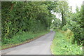
Bemzells lane, Trolliloes nr Cowbeech
Image: © Julian P Guffogg
Taken: 15 Aug 2010
0.08 miles
2
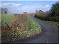
Country Lane near Trolliloes, east of Cowbeech
This view looks northwards from a minor crossroads on a back lane between Cowbeech to the left (Benzells Lane) and Bodle Street Green to the right. Ahead lies Rushlake Green and behind camera is a no-through road to Studdens Farm.
Image: © Nigel Stickells
Taken: 28 Feb 2007
0.16 miles
