IMAGES TAKEN NEAR TO
Chalvington Road, HAILSHAM, BN27 3SU
Introduction
This page details the photographs taken nearby to Chalvington Road, BN27 3SU by members of the Geograph project.
The Geograph project started in 2005 with the aim of publishing, organising and preserving representative images for every square kilometre of Great Britain, Ireland and the Isle of Man.

There are currently over 7.5m images from over14,400 individuals and you can help contribute to the project by visiting https://www.geograph.org.uk
Image Map
Images are licensed for reuse under creativecommons.org/licenses/by-sa/2.0
Notes
- Clicking on the map will re-center to the selected point.
- The higher the marker number, the further away the image location is from the centre of the postcode.
Image Listing (34 Images Found)
Images are licensed for reuse under creativecommons.org/licenses/by-sa/2.0
Image
Details
Distance
1
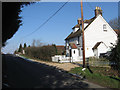
Orchard Cottage, Golden Cross
A 19th century cottage on Chalvington Road squeezed between Newhouse and Millhouse Farms.
Image: © Simon Carey
Taken: 11 Feb 2012
0.03 miles
2
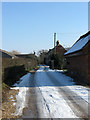
The Old Farmhouse
The original farmhouse of Millhouse Farm viewed from Chalvington Road.
Image: © Simon Carey
Taken: 11 Feb 2012
0.04 miles
3
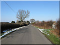
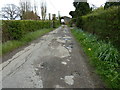
Chalvington Road
This section of the highway was made when the former Dicker Common was enclosed in 1813 and thus runs as straight as the line surveyor made with his pencil along the ruler on the plans. The original route across the common meandered a little to the east. The Golden Cross Equestrian Centre is to the left whilst Newhouse Farm is visible on the right above hedge.
Image: © Simon Carey
Taken: 11 Feb 2012
0.05 miles
4
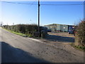
Golden Cross Equestrian Centre
A Dog Agility competition was in progress
Image: © The Saunterer
Taken: 2 Dec 2012
0.07 miles
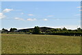
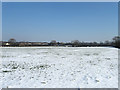
7
Noakes Field
The name of the field according to Chiddingly's 1839 tithe map formed when the old Dicker Common was enclosed in 1813. The buildings of Mill Farm are visible beyond the end of the field.
Image: © Simon Carey
Taken: 11 Feb 2012
0.10 miles
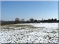
8
Middle Field
The name of the field according to Chiddingly's 1839 tithe map that was created after the enclosure of Dicker Common in 1813. Carewell House is just visible o the left whilst the bigger building to the right belongs to Golden Cross Equestrian Centre.
Image: © Simon Carey
Taken: 15 Jan 2012
0.13 miles
9
Vines Field
The name of the field according to Chiddingly's 1839 tithe map that was made when the former Dicker Common was enclosed in 1813. Viewed from Chalvington Road.
Image: © Simon Carey
Taken: 11 Feb 2012
0.14 miles
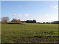
10
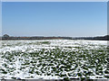
South Field
The name of the field according to Chiddingly's 1839 tithe map and made when the former Dicker Common was enclosed in 1813.
Image: © Simon Carey
Taken: 11 Feb 2012
0.15 miles