
IMAGES TAKEN NEAR TO
Summerfields Avenue, HAILSHAM, BN27 3AW
Introduction
This page details the photographs taken nearby to Summerfields Avenue, BN27 3AW by members of the Geograph project.
The Geograph project started in 2005 with the aim of publishing, organising and preserving representative images for every square kilometre of Great Britain, Ireland and the Isle of Man.

There are currently over 7.5m images from over14,400 individuals and you can help contribute to the project by visiting https://www.geograph.org.uk
Image Map
Images are licensed for reuse under creativecommons.org/licenses/by-sa/2.0
Notes
- Clicking on the map will re-center to the selected point.
- The higher the marker number, the further away the image location is from the centre of the postcode.
Image Listing (65 Images Found)
Images are licensed for reuse under creativecommons.org/licenses/by-sa/2.0
Image
Details
Distance
1
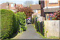
Twitten or footpath
Twitten from Beuzeville Avenue between the houses to Summerheath Road (B2104)
Image: © Edintheclouds
Taken: 15 Apr 2017
0.07 miles
2
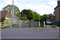
View from Summerfields Avenue
I understand this was an entrance to a Rope manufacturing factory, it's now an access road for emergency vehicles. The centre bollard can be removed at both ends for access to new housing estate.
Image: © Edintheclouds
Taken: 15 Apr 2017
0.14 miles
3

Cuckoo Trail heading south, Hailsham
Following the course of an old railway which closed here in 1968.
Image: © Robin Webster
Taken: 11 Aug 2025
0.15 miles

6

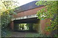
London Road, Hailsham
The B2202 as far as the road from the left, the B2104, and then London Road carries on the B2104.
Image: © Robin Webster
Taken: 11 Aug 2025
0.15 miles
7
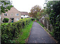
Footpath towards Western Road
The footpath crosses the Cuckoo Trail on the way from High Street to Western Road. The houses to the left are on Downsview Way.
Image: © Andrew Tatlow
Taken: 22 Oct 2015
0.16 miles
8

Cuckoo Trail - London Road Bridge, Hailsham
The trail uses the course of the former rail link between Eastbourne and Tunbridge Wells, which here opened in 1880 and closed to all traffic in 1968. The path appears to have been raised above the old track bed level under the bridge, which was reconstructed in 1994 according to a stone in the parapet.
Image: © Robin Webster
Taken: 11 Aug 2025
0.16 miles
9

Cuckoo Trail - London Road Bridge, Hailsham
The trail uses the course of the former rail link between Eastbourne and Tunbridge Wells, which here opened in 1880 and closed to all traffic in 1968. The path appears to have been raised above the old track bed level under the bridge, which was reconstructed in 1994 according to a stone in the parapet.
Image: © Robin Webster
Taken: 11 Aug 2025
0.16 miles
10
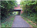
Cuckoo Trail passes beneath London Road
Image: © Andrew Tatlow
Taken: 22 Oct 2015
0.16 miles