
IMAGES TAKEN NEAR TO
Under Road, HAILSHAM, BN27 1QE
Introduction
This page details the photographs taken nearby to Under Road, BN27 1QE by members of the Geograph project.
The Geograph project started in 2005 with the aim of publishing, organising and preserving representative images for every square kilometre of Great Britain, Ireland and the Isle of Man.

There are currently over 7.5m images from over14,400 individuals and you can help contribute to the project by visiting https://www.geograph.org.uk
Image Map
Images are licensed for reuse under creativecommons.org/licenses/by-sa/2.0
Notes
- Clicking on the map will re-center to the selected point.
- The higher the marker number, the further away the image location is from the centre of the postcode.
Image Listing (16 Images Found)
Images are licensed for reuse under creativecommons.org/licenses/by-sa/2.0
Image
Details
Distance
1
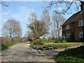
Cottages, Under Road
On the eastern side of Brent Farm are Oak Hurst and Willow Hurst respectively.
Image: © Simon Carey
Taken: 15 Apr 2010
0.02 miles
2
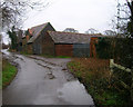
Brent Farm
Incorrectly marked as Willow Farm on the map. This view looks east along Under Road.
Image: © Simon Carey
Taken: 12 Feb 2006
0.10 miles
3
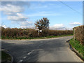
Which Way?
A junction of lanes and footpaths here, Cricketing Lane on the left heads north to Cooper's Croft; Lower Road straight ahead takes you to Golden Cross and Herstmonceux Church; the footpath on the right heads across a field called Upper Bowley as a short cut to New Bridge Road then onto the Pevensey Levels; whilst behind the photographer is Under Road which heads west to Magham Down.
Image: © Simon Carey
Taken: 11 Apr 2010
0.11 miles
4
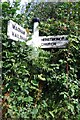
Old Direction Sign - Signpost by Lower Road, Herstmonceux
Black iron cap finial - 3 arms (1 arm in hedge); East Sussex wood by the UC road, in parish of Herstmonceux (Wealden District), Lower Road, in hedge by junction of Lower Road with Cricketing Lane and Under Road.
Surveyed
Milestone Society National ID: SX_TQ6211A
Image: © Milestone Society
Taken: Unknown
0.12 miles
5
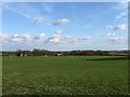
Great Field
The name of the field according to the 1839 tithe map. Beyond the trees at the bottom of the field are the Pevensey Levels.
Image: © Simon Carey
Taken: 11 Apr 2010
0.12 miles
6
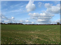
Upper Bowley (1)
The name of the field according to the 1839 tithe map. The hedgerow at the far end of the field marks the course of Lower Road.
Image: © Simon Carey
Taken: 11 Apr 2010
0.14 miles
7

Crop Field looking towards Eastbourne
Image: © Julian P Guffogg
Taken: 9 Jul 2011
0.14 miles
8
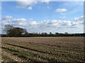
Lower Bowley
The name of the field according to the 1839 tithe map. Bowley Sewer rises in the hedgerow at the far end of the field.
Image: © Simon Carey
Taken: 11 Apr 2010
0.17 miles
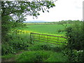
10
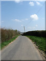
Under Road
Single track lane that leaves the A271 near Magham Down to serve the farms that overlook the northern end of the Pevensey Levels. The lane becomes Lower Road from the junction with Cricketing Lane which proceeds to head towards Herstmanceux church.
Image: © Simon Carey
Taken: 15 Apr 2010
0.19 miles