
IMAGES TAKEN NEAR TO
Falmer Road, BRIGHTON, BN2 6NB
Introduction
This page details the photographs taken nearby to Falmer Road, BN2 6NB by members of the Geograph project.
The Geograph project started in 2005 with the aim of publishing, organising and preserving representative images for every square kilometre of Great Britain, Ireland and the Isle of Man.

There are currently over 7.5m images from over14,400 individuals and you can help contribute to the project by visiting https://www.geograph.org.uk
Image Map
Images are licensed for reuse under creativecommons.org/licenses/by-sa/2.0
Notes
- Clicking on the map will re-center to the selected point.
- The higher the marker number, the further away the image location is from the centre of the postcode.
Image Listing (43 Images Found)
Images are licensed for reuse under creativecommons.org/licenses/by-sa/2.0
Image
Details
Distance
1
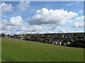
Happy Valley
The name of the valley viewed from the bridleway that runs between Old Parish Lane and Ovingdean Road. The name was already in existence prior to the arrival of the suburb of Woodingdean. The building on the far left is Image whilst the peak to its right in the distance is Newtimber Hill. The field in the foreground is now open access.
Image: © Simon Carey
Taken: 29 Aug 2011
0.04 miles
2
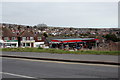
Brighton Autovets Car Services & Texaco Fuel Filling Station
On B2123 Falmer Road
http://autovets.co.uk/
Image: © Geographer
Taken: 22 Mar 2018
0.07 miles
4
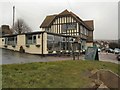
Downs Hotel
At the junction of Warren Road and Falmer Road, viewed from the west
Image: © Paul Gillett
Taken: 17 Feb 2012
0.10 miles
5
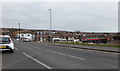
Warren Road, Woodingdean
At the junction with the B2123 Falmer Road & Warren Way
Image: © Geographer
Taken: 22 Mar 2018
0.10 miles
6
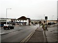
Falmer Road Junction with Warren Road
In the centre of Woodingdean, near to the Downs Hotel looking South
Image: © Paul Gillett
Taken: 17 Feb 2012
0.11 miles
7
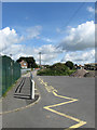
Old Parish Lane
Looking northwards towards School House. The lane is surfaced as far as the school park then becomes a bridleway heading south to Ovingdean Road.
Image: © Simon Carey
Taken: 29 Aug 2011
0.11 miles
8
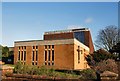
Holy Cross Church, Woodingdean
The first church was built on this site in 1941 to a traditional style. However in 1968 this was demolished to make way for the present building
Church website: http://www.woodingdeanholycross.co.cc/
Image: © Paul Gillett
Taken: 17 Jan 2010
0.11 miles
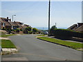
10
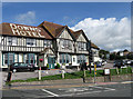
Downs Hotel
Built in 1925 when Woodingdean was little more than plots of lands with shacks and buildings and very little town planning, most of which came after 1928 when Ovingdean parish was annexed by Brighton corporation.
See http://regencysociety-jamesgray.com/volume33/source/jg_33_031.html for a 1931 image with the whitewash name on the roof already in place. Since the closure of the Toby in southern Woodingdean this is the only pub in the suburb.
Image: © Simon Carey
Taken: 29 Aug 2011
0.12 miles