IMAGES TAKEN NEAR TO
Lower Wick Street, POLEGATE, BN26 6TR
Introduction
This page details the photographs taken nearby to Lower Wick Street, BN26 6TR by members of the Geograph project.
The Geograph project started in 2005 with the aim of publishing, organising and preserving representative images for every square kilometre of Great Britain, Ireland and the Isle of Man.

There are currently over 7.5m images from over14,400 individuals and you can help contribute to the project by visiting https://www.geograph.org.uk
Image Map
Images are licensed for reuse under creativecommons.org/licenses/by-sa/2.0
Notes
- Clicking on the map will re-center to the selected point.
- The higher the marker number, the further away the image location is from the centre of the postcode.
Image Listing (11 Images Found)
Images are licensed for reuse under creativecommons.org/licenses/by-sa/2.0
Image
Details
Distance
1
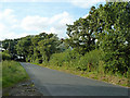
Lower Wick Street
Batbrook Cottages are behind the hedge on the right. The lanes in this area tend to be composed of straights and sharp right-angled bends. A bend to the left is ahead.
Image: © Robin Webster
Taken: 24 Aug 2011
0.01 miles
2
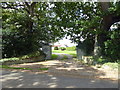
Entrance to Lower Claverham House on Lower Wick Street
Image: © PAUL FARMER
Taken: 16 Sep 2017
0.07 miles
3
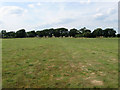
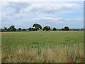
The Fifteen Acres
The name of the field according to the 1840 tithe map. A small stream runs through the field just visible on the right.
Image: © Simon Carey
Taken: 8 Aug 2010
0.12 miles
4
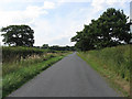
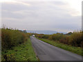
Lower Wick Street
Minor lane linking Wick Street to Mays Corner then on to Chalvington.
Image: © Simon Carey
Taken: 8 Aug 2010
0.14 miles
5
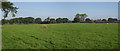
Footpath Field/Wood Field
The name of the fields according to the 1840 tithe map. Footpath Field is to the left and Wood Field to the right, the two oaks in the distance the only reminder of the old field boundary.
Image: © Simon Carey
Taken: 8 Aug 2010
0.18 miles
8
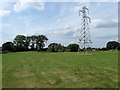
The Barn Piece
The name of the field according to the 1840 tithe map. There is a small pond between the pylons and the trees.
Image: © Simon Carey
Taken: 8 Aug 2010
0.19 miles
9
Lower Wick Street, Chalvington
Looking towards the South Downs above Firle
Image: © Kevin Gordon
Taken: 2 Nov 2008
0.21 miles
10
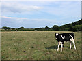
Tree Field
The name of the field according to the 1840 tithe map with one of its occupants insistent that he'll be in the picture. Ludlay Coppice is to the right.
Image: © Simon Carey
Taken: 8 Aug 2010
0.24 miles