IMAGES TAKEN NEAR TO
Common Lane, BN26 6GT
Introduction
This page details the photographs taken nearby to Common Lane, BN26 6GT by members of the Geograph project.
The Geograph project started in 2005 with the aim of publishing, organising and preserving representative images for every square kilometre of Great Britain, Ireland and the Isle of Man.

There are currently over 7.5m images from over14,400 individuals and you can help contribute to the project by visiting https://www.geograph.org.uk
Image Map
Images are licensed for reuse under creativecommons.org/licenses/by-sa/2.0
Notes
- Clicking on the map will re-center to the selected point.
- The higher the marker number, the further away the image location is from the centre of the postcode.
Image Listing (37 Images Found)
Images are licensed for reuse under creativecommons.org/licenses/by-sa/2.0
Image
Details
Distance
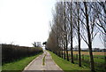
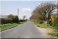
1
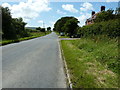
West along Common Lane
The Vanguard Way crosses the lane at this point.
Image: © Dave Spicer
Taken: 1 Jul 2012
0.07 miles
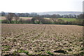
3
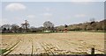
Turf Cuttings, Stonery Farm
A turf farm.
Image: © N Chadwick
Taken: 12 Apr 2010
0.08 miles
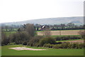
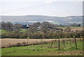
4
View over turf field to turf suppliers on Common Lane
Image: © Dave Spicer
Taken: 1 Jul 2012
0.09 miles
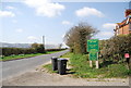
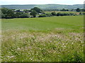
6
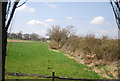
Hedge off The Vanguard Way, Stonery Farm
Image: © N Chadwick
Taken: 12 Apr 2010
0.10 miles