1
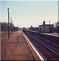
New house by the railway line, Polegate
Image: © N Chadwick
Taken: 12 Jul 2015
0.01 miles
2
The Sidings, Polegate
The Sidings is a housing development in Polegate, in East Sussex. As its name suggests, it was built on the site of former railway sidings. The railway line passes to the right, a signal stands near the centre of the image.
Image: © Malc McDonald
Taken: 11 Mar 2023
0.06 miles
3
Old railway bridge, Polegate
This bridge carried the direct south coast line on the north side of a triangular junction with the Eastbourne branch. This route is now abandoned and all traffic proceeding beyond Eastbourne has to reverse there. The bridge is not plated by any authority, yet has suffered a little damage from overheight vehicles. The road is a dead-end serving a few premises including a sewage works.
Image: © Robin Webster
Taken: 3 Sep 2011
0.08 miles
4
Bridge KJE3 649, Eastbourne line
This carries the only remaining operational railway of several lines and alignments used over the years at Polegate. Behind the viewpoint was the original curve towards Eastbourne, but there is no bridge and nothing worth photographing remains.
Image: © Robin Webster
Taken: 3 Sep 2011
0.08 miles
5
Old Polegate Railway Station, East Sussex
This rather dilapidated station closed within a few years of the photo being taken when a new station was built west to be beside the level crossing in the High Street. Ironically, the first station was in fact in the same position as the present, before the station in the photo was built, so to call the above 'old' is slightly misleading, if that makes sense! The platform to the far left served trains for the Cuckoo Line to Tunbridge Wells.
Image: © nick macneill
Taken: Unknown
0.10 miles
6
Bungalows on Pevensey Road
Image: © Oast House Archive
Taken: 26 Jun 2009
0.11 miles
7
Bus Shelter, B2247 Polegate
Image: © Julian P Guffogg
Taken: 3 Jun 2011
0.12 miles
8
Hastings Close, Polegate
Hastings Close in the village of Polegate, near Eastbourne.
Image: © Malc McDonald
Taken: 26 May 2018
0.13 miles
9
The Junction, Polegate
The Junction pub is opposite the old railway station in Polegate. The station, however, closed in 1986, being replaced by a new station about 300 metres further west.
Polegate was once at the junction of four railway lines, from Lewes, Eridge, Eastbourne and Hastings. The line to Eridge and the direct line towards Hastings have been closed for many years, so Polegate is no longer a railway junction. Trains still run from here to Hastings, but they now go via Eastbourne.
Image: © Malc McDonald
Taken: 12 Feb 2011
0.16 miles
10
The old station at Polegate
Image: © N Chadwick
Taken: 14 Apr 2011
0.16 miles


