IMAGES TAKEN NEAR TO
Seaford Road, POLEGATE, BN26 5TR
Introduction
This page details the photographs taken nearby to Seaford Road, BN26 5TR by members of the Geograph project.
The Geograph project started in 2005 with the aim of publishing, organising and preserving representative images for every square kilometre of Great Britain, Ireland and the Isle of Man.

There are currently over 7.5m images from over14,400 individuals and you can help contribute to the project by visiting https://www.geograph.org.uk
Image Map
Images are licensed for reuse under creativecommons.org/licenses/by-sa/2.0
Notes
- Clicking on the map will re-center to the selected point.
- The higher the marker number, the further away the image location is from the centre of the postcode.
Image Listing (50 Images Found)
Images are licensed for reuse under creativecommons.org/licenses/by-sa/2.0
Image
Details
Distance
1
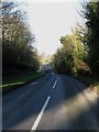
White Way
The name of the C39 between the southern edge of Alfriston and High and Over viewed here at Dukes Green.
Image: © Simon Carey
Taken: 1 Jan 2013
0.06 miles
2
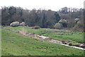
Little Deans Place Brook
The name of the field according to Alfriston's 1842 tithe map which along with, Image to its immediate north is now owned by the National Trust and known as Burnthouse Brooks.
Image: © Simon Carey
Taken: 30 Dec 2012
0.08 miles
3
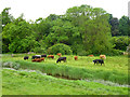
Cattle, Alfriston
Looking across the Cuckmere River at cattle mainly grazing on the river side of the far bank.
Image: © Robin Webster
Taken: 1 Jun 2016
0.09 miles
4
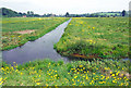
Towards Alfriston
Part of the Cuckmere river looking towards Alfriston
Image: © Andrew Huggett
Taken: 1 Apr 1999
0.09 miles
5
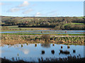
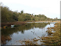
Cuckmere Flood Plain
In the foreground is Image, behind the reeds is the river whilst beyond are the flooded fields which belong to the former parish of Lullington and the houses on higher ground which are in the current parish of Litlington. Viewed from Image
Image: © Simon Carey
Taken: 1 Jan 2013
0.10 miles
6
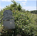
National Trust Sign: Burnt House Brooks
Image: © PAUL FARMER
Taken: 21 Jun 2018
0.10 miles
7
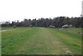
The end of the Rathfinny Trail
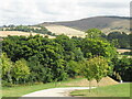
The permissive path starts - or ends - at the entrance to the Rathfinny vineyards with some of the finest views in the National Park.
Image: © David M Clark
Taken: 28 Aug 2022
0.10 miles
8
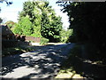
Whiteway passing through Dukes Green
Dukes Green is a collection of a few house south of Alfriston.
Image: © Dave Spicer
Taken: 13 Sep 2012
0.10 miles