IMAGES TAKEN NEAR TO
Windmill Road, POLEGATE, BN26 5BG

Introduction

This page details the photographs taken nearby to Windmill Road, BN26 5BG by members of the Geograph project.

The Geograph project started in 2005 with the aim of publishing, organising and preserving representative images for every square kilometre of Great Britain, Ireland and the Isle of Man.

There are currently over 7.5m images from over14,400 individuals and you can help contribute to the project by visiting https://www.geograph.org.uk

Image Map


Images are licensed for reuse under creativecommons.org/licenses/by-sa/2.0
Notes
  • Clicking on the map will re-center to the selected point.
  • The higher the marker number, the further away the image location is from the centre of the postcode.

Image Listing (65 Images Found)

Images are licensed for reuse under creativecommons.org/licenses/by-sa/2.0
  • ...
Image
Details
Distance
1
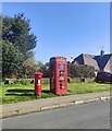
Postbox and Telephone Kiosk, Brightling Road, Polegate
Image: © PAUL FARMER Taken: 7 Apr 2024
0.08 miles
2
Little Egret on ash tree, Polegate
Image: © nick macneill Taken: 16 Feb 2012
0.13 miles
3
Church Road, Polegate
Image: © nick macneill Taken: 6 May 2013
0.14 miles
4
Old Polegate Station
Now a pub of the same name. This was actually the second Polegate station built. The original was erected on the current site but was moved when the line to Hailsham was constructed in the 1860s. It remained here until that line was lost to the Beeching Axe in 1968 and the station was moved back to its original position on Polegate High Street. The old platforms are still visible on the track.
Image: © Simon Carey Taken: 27 Jul 2006
0.16 miles
5
St John's Road , Polegate
Named after the nearby parish church.
Image: © Kevin Gordon Taken: 22 Jul 2008
0.16 miles
6
The Black Path, Polegate
This runs alongside the railway and used to be an unmade road from the old Polegate Station to the High Street. It was owned by the railway and was called the Black Path because cinders from the steam engines was used to surface it. When it was taken over and surfaced by the council in the 1980s it was named "Black Path Road" but locals used to tape over the word "road" so it is now just called "Black Path". The new Polegate Station can be seen on the far left.
Image: © Kevin Gordon Taken: 22 Jul 2008
0.17 miles
7
Polgate Station view of Combe Hill on Horizon
Image: © James Emmans Taken: 23 Apr 2016
0.18 miles
8
Polegate Railway Station, Polegate
This station is run by Southern Railway and is seen here from the nearby Level Crossing. This was the site of the original railway station which was built when the railway from Lewes to Hastings was opened in 1846. When the branch to Hailsham was re-routed a new station was opened further east towards Eastbourne. This was closed in the 1980s and is now a restaurant. In 1986 a third station (the one shown here) was built on the site of the first station.
Image: © Kevin Gordon Taken: 22 Jul 2008
0.19 miles
9
St John's church, Polegate
Opened in 1876. Architect was Robert Knott Blessley. A church hall was added to the north side in 1975.
Image: © Julian P Guffogg Taken: 24 May 2014
0.19 miles
10
Polegate Station
Image: © N Chadwick Taken: 12 Jul 2015
0.19 miles
  • ...