1
Benchmark, Arundel Road
On the northern wall of house facing Eastern Place. Listed as 25.17m above ODN.
Image: © Keith Edkins
Taken: 21 Sep 2012
0.02 miles
2
Arundel Road, Brighton
Image: © nick macneill
Taken: 13 Apr 2012
0.02 miles
3
Arundel Road, Brighton
Image: © Charles Rawding
Taken: 19 Jul 2004
0.03 miles
4
Boundary Road
Unmade road that originally linked Roedean Road, the B2118, to Marine Parade, the A259, though the latter part has now been blocked up. Named as such because the road followed the old parish boundary that separated Brighton and Ovingdean until the former annexed the latter in 1928.
Image: © Simon Carey
Taken: 29 Aug 2011
0.03 miles
5
Edwardian House, De Courcel Road
On the junction with Arundel Street this building would not look out of place in Hove.
Image: © Simon Carey
Taken: 11 Jan 2009
0.03 miles
6
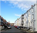
Arundel Street, Kemp Town, Brighton
A residential road that runs between Marine Parade and Boundary Road. The eastern side was developed in the late 1870s but the western side was not completed until the 1920s. Viewed from the junction with De Courcel Road.
Image: © Simon Carey
Taken: 13 Nov 2015
0.04 miles
7
De Courcel Road, Kemp Town, Brighton
A residential road running between Boundary Road and Eastern Road. On the left is the rear of the former French Convalescent Home that opened in 1898, the foundation stone being laid by the then French ambassador, Baron de Courcel.
Image: © Simon Carey
Taken: 13 Nov 2015
0.04 miles
8
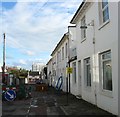
Eastern Place, Kemp Town, Brighton
A residential street initially developed as a cul de sac off Arundel Place in the 1820s but later extended to Arundel Road. The roadworks are due to mains maintenance by the gas board. Marine Gate can be seen in the distance.
Image: © Simon Carey
Taken: 13 Nov 2015
0.04 miles
9
The "Broadwalk", Brighton Marina
Looking towards the rising sun.
Image: © Bob Embleton
Taken: 10 Sep 2005
0.04 miles
10
Mermaid, Brighton Marina
Looking south across the marina to the long "east" breakwater that encompasses most of the marina.
Image: © Bob Embleton
Taken: 10 Sep 2005
0.04 miles


