
IMAGES TAKEN NEAR TO
Aldrich Close, BRIGHTON, BN2 5PX
Introduction
This page details the photographs taken nearby to Aldrich Close, BN2 5PX by members of the Geograph project.
The Geograph project started in 2005 with the aim of publishing, organising and preserving representative images for every square kilometre of Great Britain, Ireland and the Isle of Man.

There are currently over 7.5m images from over14,400 individuals and you can help contribute to the project by visiting https://www.geograph.org.uk
Image Map
Images are licensed for reuse under creativecommons.org/licenses/by-sa/2.0
Notes
- Clicking on the map will re-center to the selected point.
- The higher the marker number, the further away the image location is from the centre of the postcode.
Image Listing (20 Images Found)
Images are licensed for reuse under creativecommons.org/licenses/by-sa/2.0
Image
Details
Distance
1
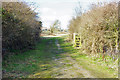
Gateway, Sheepcote Valley
In the public open space, with Wilson Avenue ahead.
Image: © Robin Webster
Taken: 2 Mar 2010
0.07 miles
2
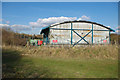
Wilson Avenue household waste recycling site
A rear view of the shed.
Image: © Robin Webster
Taken: 2 Mar 2010
0.09 miles
3
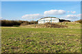
Wilson Avenue household waste recycling site
A rear view of the shed.
Image: © Robin Webster
Taken: 2 Mar 2010
0.09 miles
4

St Cuthman's Church, Whitehawk
On the day of the Whitehawk Festival
St. Cuthman's Church was originally erected in Lintott Avenue in 1937, but was destroyed on 16 August 1943 by a German bomb with a church-warden buried alive. The new church was built in 1951-2 http://www.mybrightonandhove.org.uk/page_id__6550_path__0p114p462p795p.aspx
Image: © Paul Gillett
Taken: 13 Jul 2013
0.10 miles
5
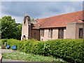
St Cuthman's church
St. Cuthman's Church was originally erected in Lintott Avenue in 1937, but was destroyed on 16 August 1943 by a German bomb with a church-warden buried alive. The new church was built in 1951-2 http://www.mybrightonandhove.org.uk/page_id__6550_path__0p114p462p795p.aspx
Image: © Paul Gillett
Taken: 12 May 2010
0.12 miles
6
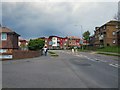
Whitehawk Way
at Junction with Wiston Road
Image: © Paul Gillett
Taken: 12 May 2010
0.15 miles
7

Lintott Avenue (South) Park
Near to St Cuthman's church during the annual Whitehawk festival
Image: © Paul Gillett
Taken: 13 Jul 2013
0.15 miles
8
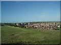
North Whitehawk
viewed from near Brighton Racecourse at the top of Manor Hill
Image: © Paul Gillett
Taken: 19 May 2009
0.17 miles
9
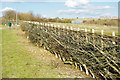
Laid hedge, Sheepcote Valley
Along the boundary of the open space, this was the result of a regional hedge laying competition held on 13/02/10, i.e. about three weeks earlier. Beyond the litter bin and a gate in the hedge, the next stretch doesn't look as good.
Image: © Robin Webster
Taken: 2 Mar 2010
0.17 miles
10
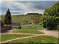
Whitehawk Hill
Viewed from near St Cuthman's church, the grandstand on Brighton Racecourse can be seen in the background, In recent years sheep have been bought onto the hill mainly as a cheap means of keeping the grass short http://www.brighton-hove.gov.uk/index.cfm?request=c1179479
As a youngster I regularly played on this hill which was known to locals as "The Steep Hill" The chalk path still visible is a short cut from Whitehawk to Manor hill
Image: © Paul Gillett
Taken: 12 May 2010
0.20 miles