1
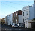
34-42, Bristol Gardens, Kemp Town, Brighton
Housing dating from the 1850s on the southern side of the road. Number 34 is on the right whilst 42 in the distance is on the corner of Bristol Place. When the road was built there were extensive nurseries and market gardens surrounding it.
Image: © Simon Carey
Taken: 13 Nov 2015
0.05 miles
2
Bennett Road, Kemp Town, Brighton
A residential road that links Bristol Gardens to Bristol Street that was developed in the early 1900s. The Whitehawk estate can be seen beyond.
Image: © Simon Carey
Taken: 13 Nov 2015
0.05 miles
3
Rugby Place, Kemp Town, Brighton
A cul de sac off Bristol Gardens that was built in the early 1880s.
Image: © Simon Carey
Taken: 13 Nov 2015
0.05 miles
4
Prince's Terrace, Kemp Town, Brighton
The original Prince's Terrace are the white buildings on the left which were built in the 1860s. The road was then extended to Bristol Street in the first decade of the 20th century.
Image: © Simon Carey
Taken: 13 Nov 2015
0.05 miles
5
Old magazine ads, Bristol Gardens
Adverts for Picture Post and (two, overpainted) for Leader Magazine, which ceased publication in 1957 and 1950 respectively
Image: © Keith Edkins
Taken: 21 Sep 2012
0.06 miles
6
Sussex Row, Bristol Gardens, Kemp Town, Brighton
The small terrace of eight houses were built in the mid 2000s on the site of the former Clyde Arms, a public house that operated from the 1880s until its closure in 2005. Bristol Gardens is the B2118.
Image: © Simon Carey
Taken: 13 Nov 2015
0.06 miles
7
Bristol Place, Kemp Town, Brighton
The road runs between Eastern Road and Bristol Road but has never been residential, the western side contains the rear entrances to houses in Sussex Square whilst for many years the eastern side was a nursery which now contains a small blocks of flats. Hollingbourne Court.
Image: © Simon Carey
Taken: 13 Nov 2015
0.07 miles
8
Whitehawk Road, Whitehawk, Brighton
The main road heading into the suburb of Whitehawk that was developed in the 1930s to house those removed from the slum clearances in the centre of the town. This section, heading north from the B2118, was built in the 1880s on what was then the Brighton side of the road, the eastern side, up to 1928, was in Ovingdean parish.
Image: © Simon Carey
Taken: 13 Nov 2015
0.08 miles
9
Whitehawk Broadway
viewed from bottom of Manor Hill
Image: © Paul Gillett
Taken: 19 May 2009
0.08 miles
10
Brighton view, with radio mast
View from Roedean Road
Image: © Keith Edkins
Taken: 21 Sep 2012
0.08 miles


