IMAGES TAKEN NEAR TO
Maresfield Road, BRIGHTON, BN2 5ER

Introduction

This page details the photographs taken nearby to Maresfield Road, BN2 5ER by members of the Geograph project.

The Geograph project started in 2005 with the aim of publishing, organising and preserving representative images for every square kilometre of Great Britain, Ireland and the Isle of Man.

There are currently over 7.5m images from over14,400 individuals and you can help contribute to the project by visiting https://www.geograph.org.uk

Image Map


Images are licensed for reuse under creativecommons.org/licenses/by-sa/2.0
Notes
  • Clicking on the map will re-center to the selected point.
  • The higher the marker number, the further away the image location is from the centre of the postcode.

Image Listing (26 Images Found)

Images are licensed for reuse under creativecommons.org/licenses/by-sa/2.0
  • ...
Image
Details
Distance
1
Whitehawk Hill
Viewed from the access road to East Brighton Golf Course with part of East Brighton Park in the foreground beyond which is the southern part of the suburb of Whitehawk and on the slopes of the hill itself, which is topped by the TV transmitter, the Manor Hill estate.
Image: © Simon Carey Taken: 23 Dec 2015
0.02 miles
2
Whitehawk Crescent
Image: © Alex McGregor Taken: 13 Aug 2014
0.07 miles
3
Whitehawk Hill transmitter mast
The transmitter serves 180,000 homes
Image: © Paul Gillett Taken: 19 May 2009
0.15 miles
4
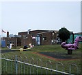
Play Area, off Manor Road
Image: © Alex McGregor Taken: 13 Aug 2014
0.15 miles
5
Donald Hall Road
In the Bristol Estate area of Brighton looking towards Whitehawk Hill
Image: © Paul Gillett Taken: 2 Jan 2011
0.15 miles
6
Bristol Estate Convenience Store
Image: © Paul Gillett Taken: 21 Mar 2013
0.16 miles
7
Green by flats in Donald Hall Road
in the Bristol Estate area of Brighton
Image: © Paul Gillett Taken: 21 Mar 2013
0.16 miles
8
Play equipment - St Marks CE Primary school
located in Manor Road, Website http://www.stmarks.brighton-hove.dbprimary.com/brighton-hove/primary/stmarks/site/pages/contact
Image: © Paul Gillett Taken: 21 Mar 2013
0.17 miles
9
Whitehawk Hill Road
To the north of St John the Baptist Catholic School the road becomes a track, a restricted byway, that heads north past the television transmitter mast and on to Manor Hill next to the racecourse. Beyond the hedges to the right are a large set of allotments.
Image: © Simon Carey Taken: 13 Nov 2015
0.18 miles
10
Whitehawk Hill Road
A very old droving road that is now a restricted byway south of Manor Hill.
Image: © Simon Carey Taken: 29 Aug 2011
0.18 miles
  • ...