IMAGES TAKEN NEAR TO
Sutton Road, SEAFORD, BN25 4QP

Introduction

This page details the photographs taken nearby to Sutton Road, BN25 4QP by members of the Geograph project.

The Geograph project started in 2005 with the aim of publishing, organising and preserving representative images for every square kilometre of Great Britain, Ireland and the Isle of Man.

There are currently over 7.5m images from over14,400 individuals and you can help contribute to the project by visiting https://www.geograph.org.uk

Image Map


Images are licensed for reuse under creativecommons.org/licenses/by-sa/2.0
Notes
  • Clicking on the map will re-center to the selected point.
  • The higher the marker number, the further away the image location is from the centre of the postcode.

Image Listing (34 Images Found)

Images are licensed for reuse under creativecommons.org/licenses/by-sa/2.0
  • ...
Image
Details
Distance
1
Sutton Corner Garage, Arundel Road
Image: © Rob Purvis Taken: 7 Jul 2010
0.02 miles
2
Eastbourne Rd, Seaford
The coast road.
Image: © N Chadwick Taken: 29 Apr 2010
0.02 miles
3
Sutton Corner Garage, Eastbourne Road, Seaford
Image: © Kevin Gordon Taken: 15 Mar 2008
0.03 miles
4
Alfriston Rd
Image: © N Chadwick Taken: 29 Apr 2010
0.04 miles
5
War Memorial
Image: © N Chadwick Taken: 7 May 2014
0.04 miles
6
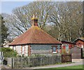
Newlands School Lodge, Seaford
At the entrance to the old school building, this was presumably a gate-keepers or caretakers lodge.
Image: © Kevin Gordon Taken: 15 Mar 2008
0.04 miles
7
Flint building, Eastbourne Rd
Image: © N Chadwick Taken: 7 May 2014
0.05 miles
8
Flint cottage, Eastbourne Rd
Image: © N Chadwick Taken: 25 Apr 2013
0.05 miles
9
P?tanque terrain, The Downs, Seaford
Ce terrain publique is tucked away in a corner of the pleasant gardens at The Downs. Seaford is next door to Newhaven. Local Britons may have brought back French amusements by the ferry from Dieppe.
Image: © Robin Stott Taken: 15 May 2021
0.06 miles
10
Hartfield Road, Seaford
Image: © Kevin Gordon Taken: 15 Mar 2008
0.06 miles
  • ...