IMAGES TAKEN NEAR TO
Hythe Close, SEAFORD, BN25 3UD
Introduction
This page details the photographs taken nearby to Hythe Close, BN25 3UD by members of the Geograph project.
The Geograph project started in 2005 with the aim of publishing, organising and preserving representative images for every square kilometre of Great Britain, Ireland and the Isle of Man.

There are currently over 7.5m images from over14,400 individuals and you can help contribute to the project by visiting https://www.geograph.org.uk
Image Map (Loading...)


Getting Data...Please wait
Leaflet Map data © OpenStreetMap
Images are licensed for reuse under creativecommons.org/licenses/by-sa/2.0
Notes
- Clicking on the map will re-center to the selected point.
- The higher the marker number, the further away the image location is from the centre of the postcode.
Image Listing (20 Images Found)
Images are licensed for reuse under creativecommons.org/licenses/by-sa/2.0
Image
Details
Distance
3
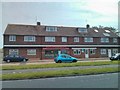
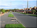
Chyngton Methodist Church, Hillside Avenue, Seaford
Image: © Kevin Gordon
Taken: 21 Mar 2008
0.17 miles
5
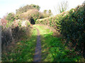
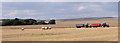
Bridleway on the outskirts of Seaford
Old route linking Chyngton Farm to pastures on Cradle Hill and beyond. The houses of Seaford are on the immediate left hand side. This view looks north.
Image: © Simon Carey
Taken: 14 Feb 2006
0.18 miles
8

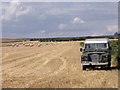
Rye Close, Seaford, East Sussex
Taken from Saltwood Road.
Image: © Kevin Gordon
Taken: 17 Apr 2008
0.20 miles
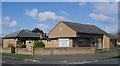
9

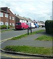
Alfriston Park, Seaford
This road was built on the site of a former Nursery and is in the far north east corner of the town.
Image: © Kevin Gordon
Taken: 22 Jul 2008
0.21 miles