IMAGES TAKEN NEAR TO
Barn Rise, SEAFORD, BN25 3DA

Introduction

This page details the photographs taken nearby to Barn Rise, BN25 3DA by members of the Geograph project.

The Geograph project started in 2005 with the aim of publishing, organising and preserving representative images for every square kilometre of Great Britain, Ireland and the Isle of Man.

There are currently over 7.5m images from over14,400 individuals and you can help contribute to the project by visiting https://www.geograph.org.uk

Image Map


Images are licensed for reuse under creativecommons.org/licenses/by-sa/2.0
Notes
  • Clicking on the map will re-center to the selected point.
  • The higher the marker number, the further away the image location is from the centre of the postcode.

Image Listing (12 Images Found)

Images are licensed for reuse under creativecommons.org/licenses/by-sa/2.0
Image
Details
Distance
1
Footpath heading down towards Queensway
Footpath from The Comp heading down towards Queensway Seaford
Image: © Shaun Ferguson Taken: 10 Apr 2011
0.14 miles
2
Un-named new road, Seaford
This road, off Barn Close is yet to be named. It is possible that it will be named Coxwell Close after Henry Coxwell a Victorian Balloonist who lived nearby. The white marks on the road are residue of frost even though the photo was taken in the last afternoon.
Image: © Kevin Gordon Taken: 30 Dec 2008
0.15 miles
3
Cradle Hill Industrial Estate Seaford
To the north of the estate a new housing estate has been built.
Image: © Dave Spicer Taken: 22 Jul 2012
0.15 miles
4
Seaford fire station
Seaford fire station, Cradle Hill Road, Seaford, East Sussex
Image: © Kevin Hale Taken: 16 Jun 2007
0.17 miles
5
Seaford cemetery
Image: © Oast House Archive Taken: 19 May 2011
0.23 miles
6
Vale Road, looking east
Image: © Rob Purvis Taken: 7 Jul 2010
0.23 miles
7
Seaford Cemetery, Alfriston Road, Seaford
Showing the cemetery chapel and on the far right the tower of the fire station.
Image: © Kevin Gordon Taken: 15 Nov 2007
0.23 miles
8
Chapel, Seaford cemetery
Quite a large cemetery with this chapel in the middle of the original area. There are two extensions chained on via narrow corridors in quite a pleasing way.
Image: © Robin Webster Taken: 6 Jul 2013
0.23 miles
9
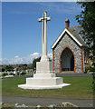
Cross of Sacrifice and Cemetery Chapel, Seaford
Image: © Kevin Gordon Taken: 9 Jul 2007
0.24 miles
10
Seaford cemetery, Alfriston Road
Opened in 1897 the site contains a number of interesting war graves including 19 from the West Indian Battalion which was based in a camp nearby during 1915. This view looks north east from just inside the entrance gates on the junction of Alfriston Road and Cradle Hill Road.
Image: © Simon Carey Taken: 14 Feb 2006
0.24 miles