IMAGES TAKEN NEAR TO
Marine Parade, SEAFORD, BN25 2PY

Introduction

This page details the photographs taken nearby to Marine Parade, BN25 2PY by members of the Geograph project.

The Geograph project started in 2005 with the aim of publishing, organising and preserving representative images for every square kilometre of Great Britain, Ireland and the Isle of Man.

There are currently over 7.5m images from over14,400 individuals and you can help contribute to the project by visiting https://www.geograph.org.uk

Image Map


Images are licensed for reuse under creativecommons.org/licenses/by-sa/2.0
Notes
  • Clicking on the map will re-center to the selected point.
  • The higher the marker number, the further away the image location is from the centre of the postcode.

Image Listing (91 Images Found)

Images are licensed for reuse under creativecommons.org/licenses/by-sa/2.0
  • ...
Image
Details
Distance
1
Beachlands Residential Home, Connaught Road, Seaford
The clean straight lines of this building show that it dates from the 1930s when it was a private home. Up until a few years ago there was a brick-built pill box on the corner (lower left) with a gun-slit facing out to sea.
Image: © Kevin Gordon Taken: 12 Jul 2008
0.02 miles
2
Marine Parade
Image: © N Chadwick Taken: 30 Jun 2020
0.04 miles
3
Beachlands Residential Care Home, Seaford
On Marine Parade, i.e. the seafront.
Image: © Robin Webster Taken: 15 Jul 2010
0.04 miles
4
Beach Huts, Seaford
These are on Bönningstedt Promenade - 20 huts installed as part of the 2017 Seafront Improvement Plan
Image: © Richard Rogerson Taken: 7 Jun 2020
0.04 miles
5
Bonningstedt Promenade
Seaford's seafront promenade renamed in 1993 after the small German town in Schleswig-Holstein that it had been twinned with since the early 1970s. Newhaven can be seen in the distance.
Image: © Simon Carey Taken: 15 Nov 2009
0.04 miles
6
Marine Court
Block of flats on the corner of Marine Parade and Connaught Road that was built in the early 1980s. The block of flats on the right is Edinburgh Court.
Image: © Simon Carey Taken: 15 Nov 2009
0.05 miles
7
Seaford Beach
Steps down from Esplanade to the beach at Seaford. In the far distance is Newhaven Harbour.
Image: © Ian Capper Taken: 1 Jan 2019
0.05 miles
8
Western end of the Promenade, Seaford
The massive retaining wall supports Marine Parade. The left-hand plaque of the two is in tribute to the 36th (Ulster) Division, who were encamped in the town in July and August 1915. The right-hand plaque celebrates 'Reconciliation and Friendship': 30 years of twinning between Seaford and Bönningstedt, 1984-2014. The small sign below notifies that the space in front is reserved for a concession.
Image: © Robin Stott Taken: 6 Sep 2019
0.06 miles
9
Shifting Shingle, Seaford Beach
The nearer of the two bulldozers from Image pushing shingle further up the beach at low tide. The beach between Seaford and Newhaven on the far side of Seaford Bay in the distance has a long history of movement with the location of the mouth of the River Ouse constantly changing until the early 18th century when the old Roman entrance was recut at its present location. The current defences date from the early 1980s when the groynes that previously defended the beaches were in dire need of replacing and opened up to the possibility of flooding. Since then shingle replenishment has been the order of the day with increasingly steep shingle banks being used to protect the town but at the expense of a beach that can be used. Furthermore, the constant access by heavy vehicles on the shingle has compacted the higher end and made it difficult for water to disperse when it does reach the top meaning Marine Parade has experienced a number of floods during heavy storms in recent years.
Image: © Simon Carey Taken: 15 Nov 2009
0.06 miles
10
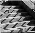
Zig-Zags
Steps leading to Marine Parade from Bonningstadt Parade, Seaford
Image: © Kevin Gordon Taken: 11 Feb 2009
0.06 miles
  • ...