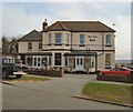
IMAGES TAKEN NEAR TO
St. Crispians, SEAFORD, BN25 2DY

Introduction

This page details the photographs taken nearby to St. Crispians, BN25 2DY by members of the Geograph project.

The Geograph project started in 2005 with the aim of publishing, organising and preserving representative images for every square kilometre of Great Britain, Ireland and the Isle of Man.

There are currently over 7.5m images from over14,400 individuals and you can help contribute to the project by visiting https://www.geograph.org.uk

Image Map


Images are licensed for reuse under creativecommons.org/licenses/by-sa/2.0
Notes
  • Clicking on the map will re-center to the selected point.
  • The higher the marker number, the further away the image location is from the centre of the postcode.

Image Listing (165 Images Found)

Images are licensed for reuse under creativecommons.org/licenses/by-sa/2.0
  • ...
Image
Details
Distance
1
Claremont Road (A259), Seaford
Image: © JThomas Taken: 6 Mar 2012
0.03 miles
2
Train between Bishopstone and Seaford
A three car class 313 unit on the local service between Brighton and Seaford.
Image: © Robin Webster Taken: 15 Jul 2010
0.03 miles
3
A259, Claremont Rd
Image: © N Chadwick Taken: 25 Apr 2013
0.05 miles
4
Salisbury Rd off A259, Seaford
Image: © N Chadwick Taken: 31 Mar 2011
0.06 miles
5
Garage on Claremont Road, Seaford
Image: © David Howard Taken: 12 Sep 2011
0.07 miles
6
Seaford, Royal British Legion
RBL building on Claremont Road. https://seafordbritishlegion.co.uk/
Image: © Mike Faherty Taken: 11 May 2019
0.08 miles
7
Car wash at BP garage by Claremont Road
Image: © David Howard Taken: 12 Sep 2011
0.08 miles
8
Flats on Claremont Road, Seaford
Image: © David Howard Taken: 12 Sep 2011
0.08 miles
9
White Lion Hotel
On the corner of Belgrave Road and Claremont Road in Seaford Website: http://www.whitelionhotel-seaford.co.uk/
Image: © Paul Gillett Taken: 28 Mar 2010
0.09 miles
10
Seaford Cricket Club, The Salts, Seaford
This low lying area was once the course of the Ouse River but was laid out as a Municipal Recreation Ground in the 1930s. There are tennis courts in the foreground. The line of houses beyond the cricket pitch is Claremont Road.
Image: © Kevin Gordon Taken: 12 Jul 2008
0.10 miles
  • ...