1
Flint wall detail, Seaford
Over a base layer or footing of large knapped flints, courses of fairly regular whole small flints are set in mortar. These old walls are seen everywhere locally. The flints were presumably quarried from chalk, though some could have been collected from the beaches below eroding chalk cliffs, where the flints occur in bands:
Image
This image reference: 7542147 (straightened to show level courses).
Image: © Robin Stott
Taken: 13 May 2023
0.01 miles
2
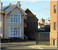
The Crouch, Crouch Lane, Seaford
The development is a staggered terrace of three-storey town houses with gardens. Garages on the left.
Image: © Robin Stott
Taken: 26 Dec 2014
0.01 miles
3
Early evening in Crouch Lane, Seaford,
Crouch Lane feels old. It rises gently from the High Street, behind the camera, to a junction on a summit before descending steeply to Steyne Road
Image
Image: © Robin Stott
Taken: 7 Sep 2019
0.01 miles
4
Little Crouch, Crouch Lane, Seaford, East Sussex
With the tower of St Leonard's Church visible on the right.
Image: © Kevin Gordon
Taken: 15 Nov 2007
0.01 miles
5
Kingsfold Court flats, Crouch Lane, Seaford
The postal address is Crouch Lane although the entrance to the flats is on the amorphous junction of Crouch Lane, left, East Street off to the right with the car park, Bramber Lane and Crooked Lane behind the camera. The 'Crouch' element of local names is unexplained.
Image: © Robin Stott
Taken: 15 May 2021
0.02 miles
6
Seaford House, Crouch Lane, Seaford, East Sussex
Image: © Kevin Gordon
Taken: 15 Nov 2007
0.02 miles
7
East street
Image: © Rob Purvis
Taken: 7 Jul 2010
0.03 miles
8
Saxon Lodge, Saxon Lane, Seaford, East Sussex
Taken from the car-park of the Barn Theatre. This was once the house of the Crook Family who did much to improve the town of Seaford.
Image: © Kevin Gordon
Taken: 15 Nov 2007
0.03 miles
9
South on Crouch Lane, Seaford
The cannon on top of the Martello Tower, now a museum, commands the Channel. Crouch Lane ascends gently from the High Street to a low summit behind the camera before gently descending towards the sea and Steyne Road. 'Crouch' may mean 'cross': the summit is an irregular crossroads at a meeting of lanes and paths. The buildings on the right bear a number of plaques referring to notable people. On the left is the Seaford and District Constitutional Club.
Image reference: 7539064
Image: © Robin Stott
Taken: 13 May 2023
0.04 miles
10
Cinque Ports pub, Seaford
Image: © Oast House Archive
Taken: 14 Jun 2014
0.04 miles


