
IMAGES TAKEN NEAR TO
Priory Close, PEVENSEY, BN24 6AD
Introduction
This page details the photographs taken nearby to Priory Close, BN24 6AD by members of the Geograph project.
The Geograph project started in 2005 with the aim of publishing, organising and preserving representative images for every square kilometre of Great Britain, Ireland and the Isle of Man.

There are currently over 7.5m images from over14,400 individuals and you can help contribute to the project by visiting https://www.geograph.org.uk
Image Map
Images are licensed for reuse under creativecommons.org/licenses/by-sa/2.0
Notes
- Clicking on the map will re-center to the selected point.
- The higher the marker number, the further away the image location is from the centre of the postcode.
Image Listing (120 Images Found)
Images are licensed for reuse under creativecommons.org/licenses/by-sa/2.0
Image
Details
Distance
1
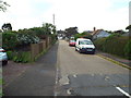
Priory Close, Pevensey Bay
Priory Close is a residential cul-de-sac in Pevensey Bay, on the East Sussex coast.
Image: © Malc McDonald
Taken: 26 May 2018
0.04 miles
2
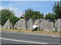
Waiting for the bus on the A259
A somewhat dazed looking participant in the Pevensey Villages scarecrow festival happily waits in comfort at a suitably askew bus-stop on the A259.
Image: © E Gammie
Taken: 16 Jul 2018
0.05 miles
3
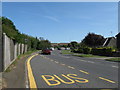
A259 Wallsend Road entering Pevensey Bay
Image: © Dave Spicer
Taken: 20 Aug 2013
0.05 miles
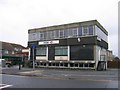
5
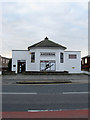
Anderida, Wallsend Road
Currently home to the Diana Freedman school of dance.
Image: © Simon Carey
Taken: 24 Jan 2010
0.07 miles
6
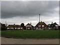
Castle Drive
A cul-de-sac off Eastbourne Road, the A259, that ends in an oval where these houses are situated.
Image: © Simon Carey
Taken: 24 Jan 2010
0.08 miles
7
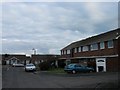
Waverley Gardens
Small estate squeezed between Coast Road and Salt Haven.
Image: © Simon Carey
Taken: 24 Jan 2010
0.08 miles
8
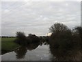
Salt Haven
The name of the waterway south of Pevensey Bridge which is a continuation of Pevensey Haven. Boats were able to navigate this until the mid 17th century when a new sluice gate was built that bought to an end Pevensey's role as a port. The waterway turns east here which suggests a medieval extension caused by the eastward movement of a shingle bank.
Image: © Simon Carey
Taken: 24 Jan 2010
0.09 miles
9
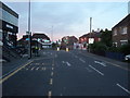
Crossroads at Pevensey
The A259 through Pevensey enters a one way system at these traffic lights.
Traffic from Bexhill, approaching the lights from the left, go straight ahead and then perform a ninety degree turn to the right to join up with the Eastbourne-Bexhill carriageway.
Image: © Bill Johnson
Taken: 23 Jun 2008
0.09 miles
10
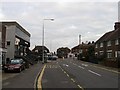
Richmond Road
Part of the one way system that takes the A259 through the centre of Pevensey Bay. The crossroads ahead rejoins the split road as well as being the western terminus of Coast Road which heads east to Normans Bay. The modern building on the left is split into two, the basement containing the local library and the top floor a branch of HSBC bank.
Image: © Simon Carey
Taken: 24 Jan 2010
0.09 miles