IMAGES TAKEN NEAR TO
Bronte Drive, PEVENSEY, BN24 5FN
Introduction
This page details the photographs taken nearby to Bronte Drive, BN24 5FN by members of the Geograph project.
The Geograph project started in 2005 with the aim of publishing, organising and preserving representative images for every square kilometre of Great Britain, Ireland and the Isle of Man.

There are currently over 7.5m images from over14,400 individuals and you can help contribute to the project by visiting https://www.geograph.org.uk
Image Map
Images are licensed for reuse under creativecommons.org/licenses/by-sa/2.0
Notes
- Clicking on the map will re-center to the selected point.
- The higher the marker number, the further away the image location is from the centre of the postcode.
Image Listing (13 Images Found)
Images are licensed for reuse under creativecommons.org/licenses/by-sa/2.0
Image
Details
Distance
1
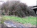
Walter House Wood
The name of the field according to the 1838 tithe map which was marked as arable back then the name a reminder of the woodland that once stood on this spot.
Image: © Simon Carey
Taken: 21 Mar 2010
0.05 miles
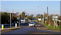
2
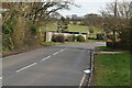
Boyles Cottages
Located on Ditton's Road next to the roundabout that provides access for the new estates on Adur Drive.
Image: © Simon Carey
Taken: 21 Mar 2010
0.14 miles
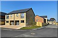
3
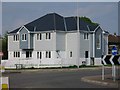
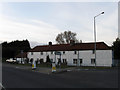
New houses at Dittons Road & St Michaels Close junction
Clad in HardiePlank fibre cement cladding.
Image: © Oast House Archive
Taken: 16 May 2016
0.18 miles
4
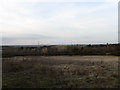
Barn Field Marsh (2)
The name of the field according to the 1838 tithe map that has now been divided into two. This is the eastern part of the former field.
Image: © Simon Carey
Taken: 21 Mar 2010
0.21 miles
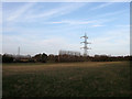
6
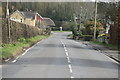
Dittons Road, Stone Cross
Dittons is a building half way between Stone Cross and Polegate. This is taken at Stone Cross Crossroads looking west. The village sign depicting a windmill can be seen on the right.
Image: © Kevin Gordon
Taken: 4 Feb 2009
0.22 miles
7
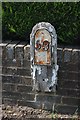
Old Milepost by the B2104, Hailsham Road, north west of Stone Cross
Metal plate attached to wooden post by the B2104, in parish of WESTHAM (WEALDEN District), North West of Stone Cross, opposite end of Milton Street, on garden wall of "Woodlands", on West side of road. Numbered iron plate, erected by the Horsebridge & Horeham turnpike trust in the 19th century.
Inscription reads:-
59
Milestone Society National ID: SX_LLE59.
Image: © JR Dowding
Taken: 11 Jul 2007
0.23 miles
8
New housing development by Stone Cross Nursery
Image: © Oast House Archive
Taken: 19 Apr 2021
0.23 miles