IMAGES TAKEN NEAR TO
Rattle Road, PEVENSEY, BN24 5DP
Introduction
This page details the photographs taken nearby to Rattle Road, BN24 5DP by members of the Geograph project.
The Geograph project started in 2005 with the aim of publishing, organising and preserving representative images for every square kilometre of Great Britain, Ireland and the Isle of Man.

There are currently over 7.5m images from over14,400 individuals and you can help contribute to the project by visiting https://www.geograph.org.uk
Image Map
Images are licensed for reuse under creativecommons.org/licenses/by-sa/2.0
Notes
- Clicking on the map will re-center to the selected point.
- The higher the marker number, the further away the image location is from the centre of the postcode.
Image Listing (15 Images Found)
Images are licensed for reuse under creativecommons.org/licenses/by-sa/2.0
Image
Details
Distance
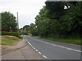
3
Rattle Field
The name of the field according to the 1838 tithe map. The western part of Westham located on Mill Hill can be seen on the higher ground in the distance.
Image: © Simon Carey
Taken: 21 Mar 2010
0.05 miles
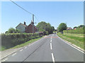
4
Cottages, Rattle Road
Grantham Cottage to the right, Elsie Cottage to the left with a brick barn just beyond as the road enters Westham.
Image: © Simon Carey
Taken: 21 Mar 2010
0.06 miles
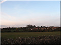
5
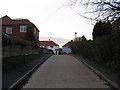
Mill View Close
Small cul-de-sac off Rattle Road that lies between Stone Cross and Westham.
Image: © Simon Carey
Taken: 21 Mar 2010
0.07 miles
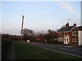
6
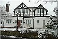
Rattle Road
House built circa 1927, originally single storey and extended 1990's. Rattle Road so named after the carts which rattled whilst transporting the bones from Gallows Lane!
Image: © Chris Bulezuik
Taken: 6 Apr 2008
0.10 miles
8
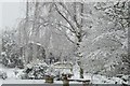
Snow April 2008
Snowy garden in Rattle Road - April 2008
Image: © Chris Bulezuik
Taken: 6 Apr 2008
0.12 miles
9
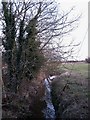
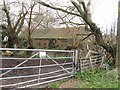
Rattle Stream
Small stream that rise near Peelings Lane before heading south onto Mountney Level.
Image: © Simon Carey
Taken: 21 Mar 2010
0.17 miles
10
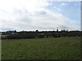
Shoulder of Mutton
The name of the field according to the 1838 tithe map and named after its shape though the 'leg' is now part of a housing estate. The houses in the distance on the left are in Mill View Close.
Image: © Simon Carey
Taken: 20 Feb 2010
0.17 miles