IMAGES TAKEN NEAR TO
Belton Close, BRIGHTON, BN2 3RY

Introduction

This page details the photographs taken nearby to Belton Close, BN2 3RY by members of the Geograph project.

The Geograph project started in 2005 with the aim of publishing, organising and preserving representative images for every square kilometre of Great Britain, Ireland and the Isle of Man.

There are currently over 7.5m images from over14,400 individuals and you can help contribute to the project by visiting https://www.geograph.org.uk

Image Map


Images are licensed for reuse under creativecommons.org/licenses/by-sa/2.0
Notes
  • Clicking on the map will re-center to the selected point.
  • The higher the marker number, the further away the image location is from the centre of the postcode.

Image Listing (213 Images Found)

Images are licensed for reuse under creativecommons.org/licenses/by-sa/2.0
  • ...
Image
Details
Distance
1
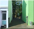
Belton Close, Round Hill, Brighton
A small cul de sac off Belton Road that was built on a small site that had originally been a nursery and was later a set of garages. The close contains five houses.
Image: © Simon Carey Taken: 11 Oct 2015
0.01 miles
2
Belton Road, Round Hill, Brighton
A residential road that heads north from Princes Crescent and was developed in the early 1890s with the exception of the northern tip that was added around 1914, see Image Next to the green house on the left is the entrance to Image
Image: © Simon Carey Taken: 11 Oct 2015
0.02 miles
3
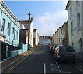
Round Hill Road, Round Hill, Brighton
A small residential road running between Ditchling Road and Belton Road that was built in the early 1880s. The latter was named after a former windmill which once existed at the northern end to the left of the lilac house in view at the top of the slope.
Image: © Simon Carey Taken: 4 Oct 2015
0.02 miles
4
Round Hill Road in Brighton
Round Hill is an inner city suburban area of Brighton. It was developed mostly in the late 19th century on an area of high land overlooking central Brighton, and contains a mix of privately owned and privately rented terraced housing. Round Hill included a windmill, which stood on the 223-foot (68 m) hilltop until 1913.
Image: © Mat Fascione Taken: 22 Aug 2022
0.02 miles
5
Belton Road in Round Hill, Brighton
Image: © Mat Fascione Taken: 23 Aug 2022
0.02 miles
6
Belton Road in Round Hill, Brighton
Image: © Mat Fascione Taken: 17 Apr 2023
0.02 miles
7
Round Hill Rd
Image: © N Chadwick Taken: 7 Jul 2018
0.02 miles
8
Prince's Crescent
Image: © N Chadwick Taken: 7 Jul 2018
0.03 miles
9
The Roundhill
The Roundhill is a plant-based restaurant and pub on the corner of Round Hill Road and Ditchling Road, in the Round Hill area of Brighton. Round Hill is an inner city suburban area of Brighton. It was developed mostly in the late 19th century on an area of high land overlooking central Brighton, and contains a mix of privately owned and privately rented terraced housing. Round Hill included a windmill, which stood on the 223-foot (68 m) hilltop until 1913. Image
Image: © Mat Fascione Taken: 22 Aug 2022
0.03 miles
10
The Roundhill at night
The Roundhill is a plant-based restaurant and pub on the corner of Round Hill Road and Ditchling Road, in the Round Hill area of Brighton. Round Hill is an inner city suburban area of Brighton. It was developed mostly in the late 19th century on an area of high land overlooking central Brighton, and contains a mix of privately owned and privately rented terraced housing. Round Hill included a windmill, which stood on the 223-foot (68 m) hilltop until 1913. Image
Image: © Mat Fascione Taken: 23 Aug 2022
0.03 miles
  • ...