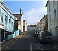
IMAGES TAKEN NEAR TO
Roundhill Street, BRIGHTON, BN2 3RG

Introduction

This page details the photographs taken nearby to Roundhill Street, BN2 3RG by members of the Geograph project.

The Geograph project started in 2005 with the aim of publishing, organising and preserving representative images for every square kilometre of Great Britain, Ireland and the Isle of Man.

There are currently over 7.5m images from over14,400 individuals and you can help contribute to the project by visiting https://www.geograph.org.uk

Image Map


Images are licensed for reuse under creativecommons.org/licenses/by-sa/2.0
Notes
  • Clicking on the map will re-center to the selected point.
  • The higher the marker number, the further away the image location is from the centre of the postcode.

Image Listing (190 Images Found)

Images are licensed for reuse under creativecommons.org/licenses/by-sa/2.0
  • ...
Image
Details
Distance
1
Round Hill Street, Round Hill, Brighton
A cul de sac off Round Hill Road that was developed in the early 1880s.
Image: © Simon Carey Taken: 11 Oct 2015
0.01 miles
2
Round Hill Rd
Image: © N Chadwick Taken: 7 Jul 2018
0.02 miles
3
Ditchling Road
West side, south of Prince's Road, BN2.
Image: © Mike Quinn Taken: 25 Jun 2014
0.02 miles
4
The Jolly Poacher, Ditchling Road, Brighton
Located on the corner of Round Hill Street and originally the Round Hill Tavern which until a few years ago was described as a standard student pub though it now appears to have gone upmarket a little along with a name change, which like most name changes appear to have divorced themselves from the community where it was placed.
Image: © Simon Carey Taken: 11 Oct 2015
0.02 miles
5
Round Hill Road, Round Hill, Brighton
A small residential road running between Ditchling Road and Belton Road that was built in the early 1880s. The latter was named after a former windmill which once existed at the northern end to the left of the lilac house in view at the top of the slope.
Image: © Simon Carey Taken: 4 Oct 2015
0.02 miles
6
Round Hill Road in Brighton
Round Hill is an inner city suburban area of Brighton. It was developed mostly in the late 19th century on an area of high land overlooking central Brighton, and contains a mix of privately owned and privately rented terraced housing. Round Hill included a windmill, which stood on the 223-foot (68 m) hilltop until 1913.
Image: © Mat Fascione Taken: 22 Aug 2022
0.02 miles
7
Belton Road, Round Hill, Brighton
This section of Belton Road to the north of the junction with Round Hill Road was built around 1914 on the former site of Round Hill Windmill. The tower mill had been built in 1838 and continued working until 1910 and was demolished in 1913 with the bricks recycled and used in the houses that replaced both the mill and its outbuildings. The last owners were the Cuttress family who acquired it in 1880 and would later go on to set up Forfars Bakery, a local chain that is still in existence today. See http://regencysociety-jamesgray.com/volume20/source/jg_20_075.htm for an image taken around 1893 with the mill located on the spot now occupied by the four terraced houses on the right. See also Image
Image: © Simon Carey Taken: 11 Oct 2015
0.03 miles
8
The Roundhill
The Roundhill is a plant-based restaurant and pub on the corner of Round Hill Road and Ditchling Road, in the Round Hill area of Brighton. Round Hill is an inner city suburban area of Brighton. It was developed mostly in the late 19th century on an area of high land overlooking central Brighton, and contains a mix of privately owned and privately rented terraced housing. Round Hill included a windmill, which stood on the 223-foot (68 m) hilltop until 1913. Image
Image: © Mat Fascione Taken: 22 Aug 2022
0.03 miles
9
The Roundhill at night
The Roundhill is a plant-based restaurant and pub on the corner of Round Hill Road and Ditchling Road, in the Round Hill area of Brighton. Round Hill is an inner city suburban area of Brighton. It was developed mostly in the late 19th century on an area of high land overlooking central Brighton, and contains a mix of privately owned and privately rented terraced housing. Round Hill included a windmill, which stood on the 223-foot (68 m) hilltop until 1913. Image
Image: © Mat Fascione Taken: 23 Aug 2022
0.03 miles
10
Prince's Rd
Image: © N Chadwick Taken: 7 Jul 2018
0.03 miles
  • ...