
IMAGES TAKEN NEAR TO
Hartington Road, BRIGHTON, BN2 3NA
Introduction
This page details the photographs taken nearby to Hartington Road, BN2 3NA by members of the Geograph project.
The Geograph project started in 2005 with the aim of publishing, organising and preserving representative images for every square kilometre of Great Britain, Ireland and the Isle of Man.

There are currently over 7.5m images from over14,400 individuals and you can help contribute to the project by visiting https://www.geograph.org.uk
Image Map
Images are licensed for reuse under creativecommons.org/licenses/by-sa/2.0
Notes
- Clicking on the map will re-center to the selected point.
- The higher the marker number, the further away the image location is from the centre of the postcode.
Image Listing (234 Images Found)
Images are licensed for reuse under creativecommons.org/licenses/by-sa/2.0
Image
Details
Distance
1

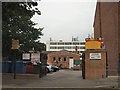
St Martins Primary School, Hartington Road, Brighton
Built in the 1970s on the site of a former railway embankment that linked the Lewes Road Viaduct with another bridge over Hartington Road. Enterprise Point is the large block in the background.
Image: © Simon Carey
Taken: 25 Oct 2015
0.01 miles
6
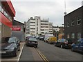
Sky Gym
In Melbourne Street off Lewes Road
Image: © Paul Gillett
Taken: 26 May 2010
0.03 miles
7
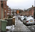
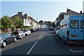
Hartington Road after snow
View from the junction of Bonchurch Road after the first snow of the winter. The road leads to Lewes Road in the background.
Image: © Paul Gillett
Taken: 5 Feb 2012
0.03 miles
9
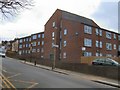
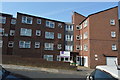
Old Viaduct Court
Sheltered housing in Hartington Road, Website: http://www.anchor.org.uk/our-services/service-search/Old-Viaduct-Court/ServiceDetail/serviceid=410
The properties are named after the former Lewes Road to Kemp Town railway which run through the site until it was closed in 1971, the last of the viaduct was removed in 1983. http://en.wikipedia.org/wiki/Kemp_Town_railway_station
Image: © Paul Gillett
Taken: 6 Mar 2011
0.04 miles
10

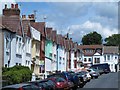
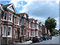
Shanklin Road, Brighton
A residential road that heads north from Hartington Road then turns east before ending at the boundary of the Brighton & Preston Cemetery. It was developed in the late 1890s.
Image: © Simon Carey
Taken: 25 Oct 2015
0.04 miles