
IMAGES TAKEN NEAR TO
Roundhill Crescent, BRIGHTON, BN2 3FR
Introduction
This page details the photographs taken nearby to Roundhill Crescent, BN2 3FR by members of the Geograph project.
The Geograph project started in 2005 with the aim of publishing, organising and preserving representative images for every square kilometre of Great Britain, Ireland and the Isle of Man.

There are currently over 7.5m images from over14,400 individuals and you can help contribute to the project by visiting https://www.geograph.org.uk
Image Map
Images are licensed for reuse under creativecommons.org/licenses/by-sa/2.0
Notes
- Clicking on the map will re-center to the selected point.
- The higher the marker number, the further away the image location is from the centre of the postcode.
Image Listing (244 Images Found)
Images are licensed for reuse under creativecommons.org/licenses/by-sa/2.0
Image
Details
Distance
1
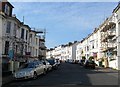
Roundhill Crescent, Round Hill, Brighton
Running in an arc on the northern side of Upper Lewes Road it was built in the early 1860s and was the last extensive piece of work Amon Henry Wilds produced for the city.
Image: © Simon Carey
Taken: 11 Oct 2015
0.03 miles
2
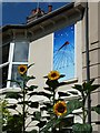
Sunflowers and a sundial on the Upper Lewes Road
A vertical declining dial facing east of south, showing 9.30am GMT
Image: © Robert Stephenson
Taken: 23 Jul 2011
0.04 miles
3
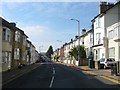
Upper Lewes Road, Brighton
The A270 that runs between the Vogue Gyratory and Ditchling Road. Much of the road was developed in the early 1870s and for nearly all the 20th century was the A27 until 1991 when the Brighton Bypass was constructed.
Image: © Simon Carey
Taken: 11 Oct 2015
0.06 miles
4

Round Hill, Brighton
A view of the suburb from Race Hill with the arc of Roundhill Crescent visible in the foreground whilst Richmond Road and Wakefield Road follow the same trajectory but further up the hill. On the left the white roof belongs Brighton Railway Depot. On the right the high rise flats are Nettleton Court whilst to its left is Brighton Council's waste transfer station.
Image: © Simon Carey
Taken: 11 Oct 2015
0.06 miles
5
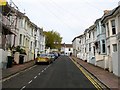
Ashdown Road, Round Hill, Brighton
A residential road that links Roundhill Crescent to Richmond Road that was developed in the early 1880s.
Image: © Simon Carey
Taken: 25 Oct 2015
0.06 miles
7
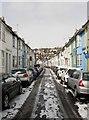
St Mary Magdalene Street
A side street that was developed in the 1860s and lies between Lewes Road and Upper Lewes Road. the houses beyond are part of the Round Hill suburb built on the hill of the same name.
Image: © Simon Carey
Taken: 12 Mar 2013
0.07 miles
8
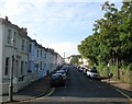
Richmond Road, Round Hill, Brighton
A residential road that runs from the corner of Image to the junction with Princes Crescent. It was developed in the early 1880s.
Image: © Simon Carey
Taken: 11 Oct 2015
0.07 miles
9

Inverness Road, Brighton
A small side street linking Lewes Road and Upper Lewes Road that was developed in the late 1860s.
Image: © Simon Carey
Taken: 25 Oct 2015
0.07 miles
10
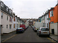
Aberdeen Road
Small residential street developed from the 1870s that links Lewes Road with Upper Lewes Road.
Image: © Simon Carey
Taken: 25 Dec 2008
0.08 miles