IMAGES TAKEN NEAR TO
Elm Grove, BRIGHTON, BN2 3DA

Introduction

This page details the photographs taken nearby to Elm Grove, BN2 3DA by members of the Geograph project.

The Geograph project started in 2005 with the aim of publishing, organising and preserving representative images for every square kilometre of Great Britain, Ireland and the Isle of Man.

There are currently over 7.5m images from over14,400 individuals and you can help contribute to the project by visiting https://www.geograph.org.uk

Image Map


Images are licensed for reuse under creativecommons.org/licenses/by-sa/2.0
Notes
  • Clicking on the map will re-center to the selected point.
  • The higher the marker number, the further away the image location is from the centre of the postcode.

Image Listing (142 Images Found)

Images are licensed for reuse under creativecommons.org/licenses/by-sa/2.0
  • ...
Image
Details
Distance
1
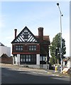
212, Elm Grove, Brighton
Located at the junction of Elm Grove and Queens Park Road is the former Race Horse Inn which opened in the late 1880s and closed around 2012 by which time it was known as the Bib & Tucker. Converted into a single domestic dwelling in 2013 with another built in its former beer garden just out of shot to the left, see Image
Image: © Simon Carey Taken: 25 Oct 2015
0.01 miles
2
Formerly Ye Racehorse Inne
Image: © N Chadwick Taken: 7 Jul 2018
0.01 miles
3
Former Ye Racehorse Inne
Image: © N Chadwick Taken: 7 Jul 2018
0.01 miles
4
311-341, Queen's Park Road, Brighton
A view of the terrace built in the early 1880s between Cromwell Street and Image The exception is number 341 next to the bus shelter which was built in the former beer garden of the Bib & Tucker pub.
Image: © Simon Carey Taken: 25 Oct 2015
0.02 miles
5
Bib & Tucker Pub
On the corner of Queens Park Road and Elm Grove, photo taken at Dusk on a snowy early December day
Image: © Paul Gillett Taken: 1 Dec 2010
0.03 miles
6
Queen's Park Rd, Elm Grove junction
Image: © N Chadwick Taken: 7 Jul 2018
0.03 miles
7
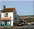
201, Elm Grove, Brighton
Home to a Happy Shopper convenience store on the corner of Totland Road.
Image: © Simon Carey Taken: 25 Oct 2015
0.03 miles
8
Cromwell Street, Brighton
The street originally ran between Queen's Park Road and Elm Grove but has now been blocked at the latter's end. Built in the early 1880s. Hollingbury Castle can be seen in the distance.
Image: © Simon Carey Taken: 25 Oct 2015
0.04 miles
9
Snow in Queens Park Road
Viewed at Dusk from the junction with Elm Grove
Image: © Paul Gillett Taken: 1 Dec 2010
0.04 miles
10
Totland Rd
Image: © N Chadwick Taken: 7 Jul 2018
0.04 miles
  • ...