
IMAGES TAKEN NEAR TO
Johnson Bank, Wellington Road, BRIGHTON, BN2 3AY
Introduction
This page details the photographs taken nearby to Johnson Bank, Wellington Road, BN2 3AY by members of the Geograph project.
The Geograph project started in 2005 with the aim of publishing, organising and preserving representative images for every square kilometre of Great Britain, Ireland and the Isle of Man.

There are currently over 7.5m images from over14,400 individuals and you can help contribute to the project by visiting https://www.geograph.org.uk
Image Map
Images are licensed for reuse under creativecommons.org/licenses/by-sa/2.0
Notes
- Clicking on the map will re-center to the selected point.
- The higher the marker number, the further away the image location is from the centre of the postcode.
Image Listing (235 Images Found)
Images are licensed for reuse under creativecommons.org/licenses/by-sa/2.0
Image
Details
Distance
1

Franklin Road, Brighton
A residential and arterial road that links Wellington Street to Lewes Road that was developed from the 1860s onwards. In the distance is the suburb of Round Hill, the large blocks of Image and to their right the suburb of Hollingdean.
Image: © Simon Carey
Taken: 25 Oct 2015
0.03 miles
2
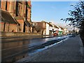
Thawing snow in Lewes Road
The snow from earlier in the day is starting to clear
St Martin's church can be seen on the left of the picture
Image: © Paul Gillett
Taken: 18 Dec 2010
0.06 miles
3
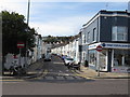
St. Paul's Street, Brighton
St. Paul's Street is a residential street in Brighton. No entry signs indicate that the street is one way only for vehicles.
Image: © Malc McDonald
Taken: 24 Aug 2019
0.07 miles

6
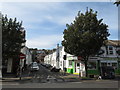
St. Martin's Street, Brighton
St. Martin's Street is a residential one-way street in Brighton.
Image: © Malc McDonald
Taken: 24 Aug 2019
0.07 miles
7
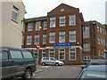
Fairlight Primary School & Nursery
Located near to Lewes Road in Central Brighton
School website: http://www.school-portal.co.uk/GroupHomepage.asp?GroupID=454579
Image: © Paul Gillett
Taken: 20 Jul 2010
0.07 miles
8
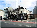
Franklin Tavern, Brighton
located on the Lewes Road http://www.pub-explorer.com/esussex/pub/franklintavernbrighton.htm
Image: © Paul Gillett
Taken: 25 Nov 2012
0.08 miles

10

Picton Street, Brighton
A residential street off Franklin Road that was developed in the late 1870s. At its northern end is the entrance to William Clarke Park.
Image: © Simon Carey
Taken: 25 Oct 2015
0.08 miles