IMAGES TAKEN NEAR TO
Oak Tree Lane, EASTBOURNE, BN23 8FB
Introduction
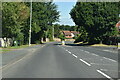
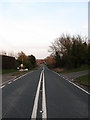
This page details the photographs taken nearby to Oak Tree Lane, BN23 8FB by members of the Geograph project.
The Geograph project started in 2005 with the aim of publishing, organising and preserving representative images for every square kilometre of Great Britain, Ireland and the Isle of Man.

There are currently over 7.5m images from over14,400 individuals and you can help contribute to the project by visiting https://www.geograph.org.uk
Image Map
Images are licensed for reuse under creativecommons.org/licenses/by-sa/2.0
Notes
- Clicking on the map will re-center to the selected point.
- The higher the marker number, the further away the image location is from the centre of the postcode.
Image Listing (8 Images Found)
Images are licensed for reuse under creativecommons.org/licenses/by-sa/2.0
Image
Details
Distance
5
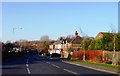
Friday Street, Stone Cross, Eastbourne
Image: © nick macneill
Taken: 3 Feb 2012
0.23 miles
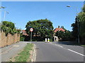
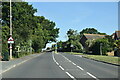
7
Rattle Road
Until the early 1990s this was the main A27 trunk road as it left Stone Cross and headed towards Westham. Since the building of the Pevensey by-pass it has been reduced to a minor road mainly providing access to the western side of Westham. Local legend has it that the name of the road derives from the rattling of the chains when bodies on a nearby gibbet would blow in the wind.
Image: © Simon Carey
Taken: 21 Mar 2010
0.24 miles