1
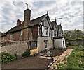
Pond in grounds of Langney Priory
Image: © PAUL FARMER
Taken: 7 May 2019
0.03 miles
2
Priory Rd, Langney
Image: © N Chadwick
Taken: 13 Jul 2020
0.04 miles
3
Langney Priory
A Grade II* Listed Building: https://britishlistedbuildings.co.uk/101043639-langney-priory-eastbourne#.XNL4q477RPZ
Image: © PAUL FARMER
Taken: 7 May 2019
0.06 miles
4
Langney Priory
A Grade II* Listed Building: https://britishlistedbuildings.co.uk/101043639-langney-priory-eastbourne#.XNL4q477RPZ
Image: © PAUL FARMER
Taken: 7 May 2019
0.06 miles
5
St Richard, Langney: early December 2015
Image: © Basher Eyre
Taken: 7 Dec 2015
0.08 miles
6
St Richard's Church, Langney
St Richard's Church at Langney dates from the 1950s. The church was extended in the 1970s, the 1980s and the 1990s. The parish dates from 1969. More about its history can be found at http://sussexparishchurches.org/product/eastbourne-st-richard-langney/ and http://discovery.nationalarchives.gov.uk/details/r/5b21adc9-edbc-464f-96ac-c5a00f1c504d
Image: © Marathon
Taken: 21 Oct 2018
0.08 miles
7
The setting of St Richard's Church, Langney
St Richard's Church at Langney dates from the 1950s. The church was extended in the 1970s, the 1980s and the 1990s. The parish dates from 1969. More about its history can be found at http://sussexparishchurches.org/product/eastbourne-st-richard-langney/ and http://discovery.nationalarchives.gov.uk/details/r/5b21adc9-edbc-464f-96ac-c5a00f1c504d
This view looks along Priory Road at the junction with Etchingham Road which is to the left here.
Image: © Marathon
Taken: 21 Oct 2018
0.08 miles
8
The church hall of St Richard's Church, Langney
St Richard's Church at Langney dates from the 1950s. The church was extended in the 1970s, the 1980s and the 1990s. The parish dates from 1969. More about its history can be found at http://sussexparishchurches.org/product/eastbourne-st-richard-langney/ and http://discovery.nationalarchives.gov.uk/details/r/5b21adc9-edbc-464f-96ac-c5a00f1c504d
Image: © Marathon
Taken: 21 Oct 2018
0.08 miles
9
St Richard's Church, Langney
St Richard's Church at Langney dates from the 1950s. The church was extended in the 1970s, the 1980s and the 1990s. The parish dates from 1969. More about its history can be found at http://sussexparishchurches.org/product/eastbourne-st-richard-langney/ and http://discovery.nationalarchives.gov.uk/details/r/5b21adc9-edbc-464f-96ac-c5a00f1c504d
Image: © Marathon
Taken: 21 Oct 2018
0.08 miles
10
New housing off Pevensey Bay Road
Render and fibre cement clad houses, built 2013.
Image: © Oast House Archive
Taken: 28 Apr 2015
0.11 miles


