IMAGES TAKEN NEAR TO
Delavall Walk, EASTBOURNE, BN23 6ER
Introduction
This page details the photographs taken nearby to Delavall Walk, BN23 6ER by members of the Geograph project.
The Geograph project started in 2005 with the aim of publishing, organising and preserving representative images for every square kilometre of Great Britain, Ireland and the Isle of Man.

There are currently over 7.5m images from over14,400 individuals and you can help contribute to the project by visiting https://www.geograph.org.uk
Image Map
Images are licensed for reuse under creativecommons.org/licenses/by-sa/2.0
Notes
- Clicking on the map will re-center to the selected point.
- The higher the marker number, the further away the image location is from the centre of the postcode.
Image Listing (85 Images Found)
Images are licensed for reuse under creativecommons.org/licenses/by-sa/2.0
Image
Details
Distance
1
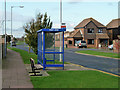
What bus stop is this?
The shelter says Hardy Drive: the sign says Columbus Drive. The stop is on Ramsay Way. Hardy Drive is a left turn close to this stop: Columbus Drive is a right turn further away.
Image: © Robin Webster
Taken: 17 Nov 2011
0.08 miles
4

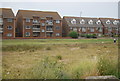
Sovereign Park, Eastbourne, East Sussex
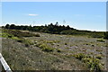
The photo shows part of Sovereign Park, which is a coastal landscape consisting partly of fossil storm beaches formed centuries before by strong waves and currents. Shingle was driven onshore, and ridges of flint pebbles were formed. Around the year 1600 a shingle foreland existed up to one and a half kilometres south of the location shown in the photo, but conditions changed, and for the last 400 years coastal erosion took place before the building of a groyne field in the 1800s helped to slow that process.
The undulating surface of Sovereign Park is formed of sorted beach material similar in nature to that of modern beaches such as those lying adjacent to it. The uneven former beach surface of the park provides a number of microhabitats that are suitable for an assemblage of pioneering plants that are adapted to growing in tough conditions, as the area can be cold, dry, windy, sunny and hot at different times but where the soil is always thin, salty and lacking in nutrients. Plants that are adapted to this harsh environment include sea kale, yellow-horned poppy, wild carrot, Viper's bugloss and sea campion. Red valerian is also naturalised within the park, though it was introduced from the Mediterranean.
Image: © Andrew Diack
Taken: 28 Nov 2024
0.10 miles
7
Eastbourne Promenade near Sovereign Park, Eastbourne
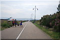
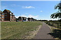
From a position on the promenade opposite Bay 82, the photo shows the promenade and cycle track near Sovereign Park, Langney. The promenade is bordered by beaches on one side and by a fringing area of grass on the other. With a number of car parks in the area, the level, wheelchair- friendly walkway of the promenade is popular with walkers and dog walkers.
Image: © Andrew Diack
Taken: 14 Nov 2024
0.12 miles
8

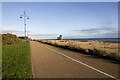
Eastbourne Promenade opposite Bays 80 and 81, East Sussex
Eastbourne Promenade is an often much-used facility that runs along the coast from Holywell in the west to Langney Point in the east. The section shown of Eastern Parade lies opposite Sovereign Park, with the view being from opposite Bay 80 toward the more distant blue refuse bin opposite Bay 81 and then beyond that. The side of the track nearer the beach is for the use of cyclists, while the inside lane is for the use of pedestrians.
Image: © Andrew Diack
Taken: 13 Jun 2025
0.12 miles