IMAGES TAKEN NEAR TO
Mountbatten Drive, EASTBOURNE, BN23 6BE
Introduction
This page details the photographs taken nearby to Mountbatten Drive, BN23 6BE by members of the Geograph project.
The Geograph project started in 2005 with the aim of publishing, organising and preserving representative images for every square kilometre of Great Britain, Ireland and the Isle of Man.

There are currently over 7.5m images from over14,400 individuals and you can help contribute to the project by visiting https://www.geograph.org.uk
Image Map
Images are licensed for reuse under creativecommons.org/licenses/by-sa/2.0
Notes
- Clicking on the map will re-center to the selected point.
- The higher the marker number, the further away the image location is from the centre of the postcode.
Image Listing (13 Images Found)
Images are licensed for reuse under creativecommons.org/licenses/by-sa/2.0
Image
Details
Distance
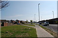
1
Ramsey Way
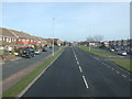
Main road to Langney Point, behind the camera.
Image: © Dave Spicer
Taken: 20 Aug 2013
0.07 miles


9
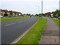
Princes Road, Eastbourne
Built in the 1950s and 60s the road stretches between the A259 Langney Roundabout and Sovereign Roundabout near the sea.
Image: © Simon Carey
Taken: 28 May 2006
0.22 miles