IMAGES TAKEN NEAR TO
Howletts Close, EASTBOURNE, BN22 9NP
Introduction
This page details the photographs taken nearby to Howletts Close, BN22 9NP by members of the Geograph project.
The Geograph project started in 2005 with the aim of publishing, organising and preserving representative images for every square kilometre of Great Britain, Ireland and the Isle of Man.

There are currently over 7.5m images from over14,400 individuals and you can help contribute to the project by visiting https://www.geograph.org.uk
Image Map
Images are licensed for reuse under creativecommons.org/licenses/by-sa/2.0
Notes
- Clicking on the map will re-center to the selected point.
- The higher the marker number, the further away the image location is from the centre of the postcode.
Image Listing (43 Images Found)
Images are licensed for reuse under creativecommons.org/licenses/by-sa/2.0
Image
Details
Distance
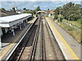
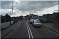
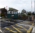
3
Mountfield Road level crossing Hampden Park
Image: © Roy Hughes
Taken: 9 Sep 2019
0.11 miles
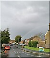
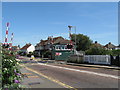
5
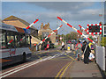
Mountfield Road railway crossing
Image: © Oast House Archive
Taken: 23 Sep 2011
0.11 miles
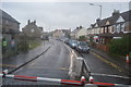
6
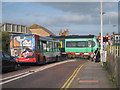
Mountfield Road railway crossing
Image: © Oast House Archive
Taken: 23 Sep 2011
0.11 miles
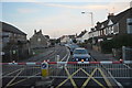
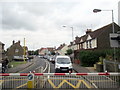
9
Hampden Park level crossing and signal box
Image: © Dave Spicer
Taken: 20 Aug 2013
0.12 miles