
IMAGES TAKEN NEAR TO
Exeter Close, EASTBOURNE, BN22 0LA
Introduction
This page details the photographs taken nearby to Exeter Close, BN22 0LA by members of the Geograph project.
The Geograph project started in 2005 with the aim of publishing, organising and preserving representative images for every square kilometre of Great Britain, Ireland and the Isle of Man.

There are currently over 7.5m images from over14,400 individuals and you can help contribute to the project by visiting https://www.geograph.org.uk
Image Map
Images are licensed for reuse under creativecommons.org/licenses/by-sa/2.0
Notes
- Clicking on the map will re-center to the selected point.
- The higher the marker number, the further away the image location is from the centre of the postcode.
Image Listing (147 Images Found)
Images are licensed for reuse under creativecommons.org/licenses/by-sa/2.0
Image
Details
Distance
3
![Willingdon buildings [1]](https://s2.geograph.org.uk/geophotos/07/19/71/7197146_d6f69262_120x120.jpg)
Willingdon buildings [1]
This building was originally Willingdon village school and school-master's house. The school was converted into the Church Hall in 1953 and the house is now Church House, number 37 Church Street. Built in the mid 19th century of knapped flint with stone dressings and quoins under a tile roof. There is another image of the building at Image Listed, grade II, with details at: https://historicengland.org.uk/listing/the-list/list-entry/1028501
Once isolated villages, Upper Willingdon and Lower Willingdon, are now part of the built-up area of Eastbourne. Set on a spur at the foot of the South Downs, the village lies astride the A22 road, about 1 mile south of Polegate. There is evidence of occupation since the pre-Saxon age.
Image: © Michael Dibb
Taken: 2 May 2022
0.08 miles
4
![Willingdon buildings [2]](https://s0.geograph.org.uk/geophotos/07/19/71/7197148_58f07b48_120x120.jpg)
Willingdon buildings [2]
Seen across Eastbourne Road, this building was originally Willingdon village school and school-master's house. The school was converted into the Church Hall in 1953 and the house is now Church House, number 37 Church Street. Built in the mid 19th century of knapped flint with stone dressings and quoins under a tile roof. There is another image of the building at Image Listed, grade II, with details at: https://historicengland.org.uk/listing/the-list/list-entry/1028501
Once isolated villages, Upper Willingdon and Lower Willingdon, are now part of the built-up area of Eastbourne. Set on a spur at the foot of the South Downs, the village lies astride the A22 road, about 1 mile south of Polegate. There is evidence of occupation since the pre-Saxon age.
Image: © Michael Dibb
Taken: 10 May 2022
0.08 miles
5
![Willingdon houses [4]](https://s2.geograph.org.uk/geophotos/07/19/71/7197138_12ab8071_120x120.jpg)
Willingdon houses [4]
Elm Tree Cottage, number 51 Church Street, was built in the 18th century. Constructed of painted brick under a tile roof. Listed, grade II, with details at: https://historicengland.org.uk/listing/the-list/list-entry/1299922
Once isolated villages, Upper Willingdon and Lower Willingdon, are now part of the built-up area of Eastbourne. Set on a spur at the foot of the South Downs, the village lies astride the A22 road, about 1 mile south of Polegate. There is evidence of occupation since the pre-Saxon age.
Image: © Michael Dibb
Taken: 10 May 2022
0.08 miles
6
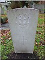
St Mary, Willingdon: churchyard (g)
Also see http://www.cwgc.org/find-war-dead/casualty/659669/READ,%20W
Image: © Basher Eyre
Taken: 7 Dec 2015
0.08 miles
8
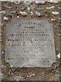
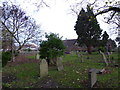
St Mary, Willingdon: memorial (1)
Also see https://en.wikipedia.org/wiki/Queen_Victoria#Golden_Jubilee
Image: © Basher Eyre
Taken: 7 Dec 2015
0.08 miles
9
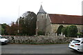
Willingdon church clock stuck at 12:19, Willingdon, East Sussex
The clock in the church tower at St Mary the Virgin has not been working properly for some time. Currently the clock is stuck at 12:19. Clockmakers from Derby are working to fix the problem.
Image: © Andrew Diack
Taken: 15 Oct 2021
0.08 miles
10
![Parish church [1]](https://s3.geograph.org.uk/geophotos/07/19/71/7197155_5fcafe00_120x120.jpg)
Parish church [1]
The Anglican parish church of St Mary the Virgin stands in Church Street. The separate tower is late 12th century or early 13th century, The nave and aisle are 14th century and the chancel is late 14th or early 15th century. Constructed of flint and stone with sandstone ashlar dressings. The roof is supported by a kingpost. Listed, grade I, with details at: https://historicengland.org.uk/listing/the-list/list-entry/1184822
Once isolated villages, Upper Willingdon and Lower Willingdon, are now part of the built-up area of Eastbourne. Set on a spur at the foot of the South Downs, the village lies astride the A22 road, about 1 mile south of Polegate. There is evidence of occupation since the pre-Saxon age.
Image: © Michael Dibb
Taken: 2 May 2022
0.08 miles