IMAGES TAKEN NEAR TO
Downs Road, EASTBOURNE, BN22 0JG
Introduction
This page details the photographs taken nearby to Downs Road, BN22 0JG by members of the Geograph project.
The Geograph project started in 2005 with the aim of publishing, organising and preserving representative images for every square kilometre of Great Britain, Ireland and the Isle of Man.

There are currently over 7.5m images from over14,400 individuals and you can help contribute to the project by visiting https://www.geograph.org.uk
Image Map
Images are licensed for reuse under creativecommons.org/licenses/by-sa/2.0
Notes
- Clicking on the map will re-center to the selected point.
- The higher the marker number, the further away the image location is from the centre of the postcode.
Image Listing (143 Images Found)
Images are licensed for reuse under creativecommons.org/licenses/by-sa/2.0
Image
Details
Distance
6
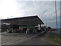
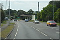
BP filling station on Eastbourne Road, Willingdon
Image: © David Howard
Taken: 3 Apr 2016
0.07 miles
7
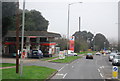
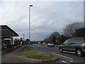
Filling Station, Eastbourne Rd, Willingdon
Image: © N Chadwick
Taken: 31 Mar 2011
0.09 miles
8
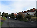
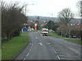
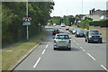
Coopers Hill
Originally the main road through the village of Willingdon but bypassed as early as the 1920s.
Image: © Simon Carey
Taken: 24 Jan 2009
0.10 miles
9
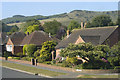
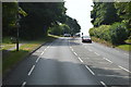
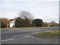
Looking towards the Downs from Meadows Road
Looking south-west from the corner of Downs Road with Meadows Road towards Combe Hill.
Image: © Andrew Huggett
Taken: 6 Aug 2004
0.13 miles