1
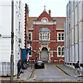
Steine Gardens, Brighton
A cul de sac off Edward Street that was developed in the 1790s. Just in view on the right is Parochial Mews built on the site of the former Parochial Offices.
Image: © Simon Carey
Taken: 1 Nov 2015
0.01 miles
2
Former Parochial Offices, Brighton
A grade II listed building, opened in 1895 and dated 1894. This is just a glimpse of the central front door in the fairly long building.
Image: © Robin Webster
Taken: 13 Apr 2019
0.02 miles
3
Old Parochial Offices
Red brick buildings in Princes Street, the buildings are grade 2 listed http://www.britishlistedbuildings.co.uk/en-481100-former-parochial-offices-brighton, see http://www.mybrightonandhove.org.uk/page_id__8419_path__0p116p1590p.aspx for a history of the building
Image: © Paul Gillett
Taken: 18 Jun 2011
0.02 miles
4
Prince's Street, BN1
Image: © Mike Quinn
Taken: 1 May 2012
0.02 miles
5
Princes Street
A narrow street that runs between the Old Steine and Edward Street that contains the former Parochial Offices to the right.
Image: © Simon Carey
Taken: 1 Nov 2011
0.02 miles
6
Edward Street
Head south down Grand Parade then Pavilion Parade until the junction with Edward Street is reached. Edward Street was built on what was known as a leakway a path dividing two separate Laines, in this case Hilly Laine to the north and Little Laine to the south. This area was built up from 1800 onwards and the Hilly Laine area soon became home to the town's slums. Edward Street was once only 25 feet across but the northern side was cleared and widened between 1961-64 as a planned dual carriageway out of town. The street retains a number of buildings on its southern side as a reminder of the street's previous role as a shopping area for the poorer areas of town. What shops remain now serve the big employers of the northern side of the street.
Click on the link to take you to the next page. http://www.geograph.org.uk/photo/231411
Image: © Simon Carey
Taken: 1 Sep 2006
0.02 miles
7
The Marlborough Hotel, Pavilion Street, BN1
Image: © Mike Quinn
Taken: 1 May 2012
0.02 miles
8
Sign for The Marlborough Hotel, Pavilion Street, BN1
Image: © Mike Quinn
Taken: 1 May 2012
0.03 miles
9
The Marlborough Pub and Theatre, Brighton
On the corner of Pavilion Street and Prince's Street. The Marlborough Pub and Theatre is a historic venue, situated at 4 Princes Street, Brighton. It has been associated, since the 1970s, with the LGBT community. The Marlborough's small theatre presents a diverse range of theatre, cabaret and music throughout the year, including during the Brighton Fringe Festival, LGBT History Month and Brighton Pride Arts Festival.
Image: © pam fray
Taken: 6 Apr 2017
0.03 miles
10
Edward VII postbox, Preston Parade / Pavilion Street
Image: © Mike Quinn
Taken: 25 Jun 2008
0.03 miles


