IMAGES TAKEN NEAR TO
Madeira Place, BRIGHTON, BN2 1TN
Introduction
This page details the photographs taken nearby to Madeira Place, BN2 1TN by members of the Geograph project.
The Geograph project started in 2005 with the aim of publishing, organising and preserving representative images for every square kilometre of Great Britain, Ireland and the Isle of Man.

There are currently over 7.5m images from over14,400 individuals and you can help contribute to the project by visiting https://www.geograph.org.uk
Image Map
Images are licensed for reuse under creativecommons.org/licenses/by-sa/2.0
Notes
- Clicking on the map will re-center to the selected point.
- The higher the marker number, the further away the image location is from the centre of the postcode.
Image Listing (1745 Images Found)
Images are licensed for reuse under creativecommons.org/licenses/by-sa/2.0
Image
Details
Distance
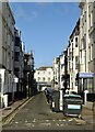
1
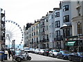
Madeira Place, BN1
Looking down from St. James's Street towards the Image
Image: © Mike Quinn
Taken: 22 May 2012
0.00 miles
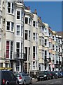
2
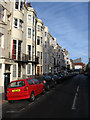
Madeira Place
Developed in the last decade of the 18th century along farmland formerly known as Cliff Furlong. A villa known as Jermyn Place had been constructed in 1782 and the road was named after it though it was corrupted into German Place after a few years. This lasted until 1915 when it was renamed Madeira Place. The street runs north-south between Marine Parade and St James' Street.
Image: © Simon Carey
Taken: 11 Jan 2009
0.00 miles
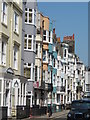
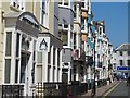
3

Madeira Place, Brighton
This small street is typical of the streets running off the seafront road of Marine Parade. In between Marine Parade and the sea is the beach road known as Madeira Drive.
Image: © Nigel Mykura
Taken: 12 Feb 2011
0.01 miles
4
Saint-James, St James' Street
Head east up St James Street until the junction of Madeira Place. The latter was developed from the 1780s onwards and originally named after Jermyn Place a villa built in 1781-82. The plots around the villa were soon developed and the road became Jermyn Place which was somehow corrupted into German Place the name it retained until 1914 when it was renamed Madeira Place.
Click on the link to take you to the next page. http://www.geograph.org.uk/photo/231471
Image: © Simon Carey
Taken: 1 Sep 2006
0.02 miles
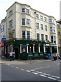
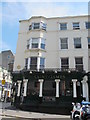
6
Broad Street, Brighton
Developed from 1776 onwards it connects Marine Parade, the A259, with St James's Street, the B2066.
Image: © Simon Carey
Taken: 2 Jan 2025
0.02 miles
9
The Saint James, St. James's Street / Madeira Place, BN2
Image: © Mike Quinn
Taken: 22 May 2012
0.03 miles
10
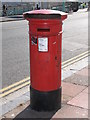
Victorian postbox, Marine Parade
Image: © Mike Quinn
Taken: 23 Jun 2008
0.03 miles