1
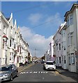
College Place, BN2 (2)
North of St. George's Road.
Image: © Mike Quinn
Taken: 24 Apr 2012
0.01 miles
2
Sign for The Ginger Dog, College Place / Clarendon Place, BN2
Image: © Mike Quinn
Taken: 24 Apr 2012
0.01 miles
3
Kemp Town, Ginger Dog
On College Place; ostensibly a Victorian corner local, but now principally a Michelin-listed restaurant. Back counter, small bar area left, dining areas far left and back. Cask ales on offer: Cellar Head Summer Pale, Franklins Mama Knows Best, Hand Brew Low Five.
Image: © Mike Faherty
Taken: 20 Oct 2018
0.01 miles
4
The Ginger Dog, College Place / Clarendon Place, BN2
Image: © Mike Quinn
Taken: 24 Apr 2012
0.01 miles
5
30, College Place, Kemp Town, Brighton
Located on the southern corner of Great College Street the building began life as a public house in the 1850s, initially Lewes Arms then the College Arms but had closed by 1862. It then became a grocer and during much of the 20th century it was Munnery's off licence. Now a private dwelling.
Image: © Simon Carey
Taken: 13 Nov 2015
0.02 miles
6
Clarendon Place, Kemp Town, Brighton
A small residential road linking College Place to College Road that was developed in the late 1850s. The high rise flats in the distance are Essex Place to the left, Somerset Point in the middle and Hereford Court to the right.
Image: © Simon Carey
Taken: 4 Oct 2015
0.02 miles
7
College Place, Kemp Town, Brighton
A residential street that links Eastern Road to St George's Road that was developed in the early 1830s. The houses on the left and the lamp post in front of them are all listed.
Image: © Simon Carey
Taken: 4 Oct 2015
0.03 miles
8
42, College Place, Kemp Town, Brighton
The current set of flats look like a rebuild or redevelopment but occupy the site of what was once the Dolphin Tavern which operated here from the 1850s until its closure around 1909. Located on the corner of Bloomsbury Street.
Image: © Simon Carey
Taken: 13 Nov 2015
0.03 miles
9
College Gardens, BN2
Image: © Mike Quinn
Taken: 24 Apr 2012
0.03 miles
10
Sign for The Golden Cannon, St. George's Road / College Place, BN2
Image: © Mike Quinn
Taken: 24 Apr 2012
0.03 miles


