
IMAGES TAKEN NEAR TO
Lewes Mews, Arundel Place, BRIGHTON, BN2 1GR
Introduction
This page details the photographs taken nearby to Lewes Mews, Arundel Place, BN2 1GR by members of the Geograph project.
The Geograph project started in 2005 with the aim of publishing, organising and preserving representative images for every square kilometre of Great Britain, Ireland and the Isle of Man.

There are currently over 7.5m images from over14,400 individuals and you can help contribute to the project by visiting https://www.geograph.org.uk
Image Map
Images are licensed for reuse under creativecommons.org/licenses/by-sa/2.0
Notes
- Clicking on the map will re-center to the selected point.
- The higher the marker number, the further away the image location is from the centre of the postcode.
Image Listing (334 Images Found)
Images are licensed for reuse under creativecommons.org/licenses/by-sa/2.0
Image
Details
Distance
1
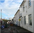
Eastern Place, Kemp Town, Brighton
A residential street initially developed as a cul de sac off Arundel Place in the 1820s but later extended to Arundel Road. The roadworks are due to mains maintenance by the gas board. Marine Gate can be seen in the distance.
Image: © Simon Carey
Taken: 13 Nov 2015
0.02 miles
2
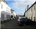
Arundel Mews, Kemp Town, Brighton
Located off Arundel Place and probably built at the same time. The block in the background is Marine Gate.
Image: © Simon Carey
Taken: 13 Nov 2015
0.03 miles
3
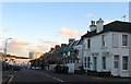
Eastern Road, Kemp Town, Brighton
A view of the road from the junction with Arundel Place on the right. A major arterial route that begins as a continuation of Edward Street to the west and ends at Arundel Street visible in the distance.
Image: © Simon Carey
Taken: 13 Nov 2015
0.04 miles
4
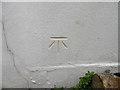
Benchmark, Arundel Road
On the northern wall of house facing Eastern Place. Listed as 25.17m above ODN.
Image: © Keith Edkins
Taken: 21 Sep 2012
0.04 miles
5

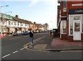
Houses on B2137 Arundel Road, Brighton
A very short B road. The low grey building is a pub or bar, of the sort that these days has a series of short-lived names, currently The Bell Tower.
Image: © Robin Webster
Taken: 26 May 2025
0.04 miles
7
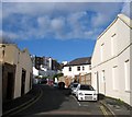
Arundel Place, Kemp Town, Brighton
Built as a service road in the 1820s for the houses on the eastern side of Arundel Terrace, Lewes Crescent and Sussex Square.
Image: © Simon Carey
Taken: 13 Nov 2015
0.05 miles
8
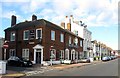
The New Bush, Arundel Road, Kemp Town, Brighton
Opened in the 1850s as the Bush Inn when it was the only property in the road the rest of which wasn't developed until the late 1890s.
Image: © Simon Carey
Taken: 13 Nov 2015
0.05 miles
10
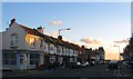
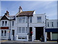
Arundel Road, Kemp Town, Brighton
The B2118 from Marine parade to the junction with Bristol Gardens, Whitehawk Road and Roedean Road. The road was laid out in the 1850s but not really developed with housing until the early 1900s. Between 1897 and 1932 it was part of the main road out of Brighton when cliff falls at Black Rock closed the old clifftop highway. Viewed from the junction with Eastern Road with the old French Convalescent Home visible in the distance.
Image: © Simon Carey
Taken: 13 Nov 2015
0.06 miles