IMAGES TAKEN NEAR TO
Arundel Mews, Arundel Place, BRIGHTON, BN2 1GG

Introduction

This page details the photographs taken nearby to Arundel Mews, Arundel Place, BN2 1GG by members of the Geograph project.

The Geograph project started in 2005 with the aim of publishing, organising and preserving representative images for every square kilometre of Great Britain, Ireland and the Isle of Man.

There are currently over 7.5m images from over14,400 individuals and you can help contribute to the project by visiting https://www.geograph.org.uk

Image Map


Images are licensed for reuse under creativecommons.org/licenses/by-sa/2.0
Notes
  • Clicking on the map will re-center to the selected point.
  • The higher the marker number, the further away the image location is from the centre of the postcode.

Image Listing (325 Images Found)

Images are licensed for reuse under creativecommons.org/licenses/by-sa/2.0
  • ...
Image
Details
Distance
1
Arundel Mews, Kemp Town, Brighton
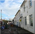
Located off Arundel Place and probably built at the same time. The block in the background is Marine Gate.
Image: © Simon Carey Taken: 13 Nov 2015
0.01 miles
2
Arundel Place, Kemp Town, Brighton
Built as a service road in the 1820s for the houses on the eastern side of Arundel Terrace, Lewes Crescent and Sussex Square.
Image: © Simon Carey Taken: 13 Nov 2015
0.02 miles
3
Arundel Place
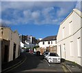
Side street connecting Eastern Road to Arundel Road and originally built to serve the rear of the great houses on the right that form part of Sussex Square and Lewes Crescent, straight ahead.
Image: © Simon Carey Taken: 29 Aug 2011
0.03 miles
4
Eastern Road, Kemp Town, Brighton
A view of the road from the junction with Arundel Place on the right. A major arterial route that begins as a continuation of Edward Street to the west and ends at Arundel Street visible in the distance.
Image: © Simon Carey Taken: 13 Nov 2015
0.04 miles
5
Eastern Place, Kemp Town, Brighton
A residential street initially developed as a cul de sac off Arundel Place in the 1820s but later extended to Arundel Road. The roadworks are due to mains maintenance by the gas board. Marine Gate can be seen in the distance.
Image: © Simon Carey Taken: 13 Nov 2015
0.04 miles
6
Lewes Crescent, Brighton
Image: © Paul Gillett Taken: 14 Feb 2013
0.04 miles
7
Sussex Square, BN2 (east side, south of Eastern Road)
Image: © Mike Quinn Taken: 19 Apr 2012
0.05 miles
8
Lewes Crescent
Image: © N Chadwick Taken: 13 Jul 2013
0.05 miles
9
Sussex Square, Kemp Town, Brighton
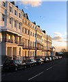
A view of numbers 41-50 on the eastern side between Eastern Road and Lewes Crescent catching the late afternoon sun.
Image: © Simon Carey Taken: 13 Nov 2015
0.05 miles
10
Sussex Square
Part of the original Kemp Town developed by Thomas Kemp between 1822-30. Lewis Carroll lived at number 11 between 1874-87 and is still a very desirable place to live. This is the eastern side viewed from the point where the road becomes Lewes Crescent.
Image: © Simon Carey Taken: 11 Jan 2009
0.06 miles
  • ...