1
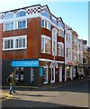
The Thomas Kemp, St George's Road, Kemp Town, Brighton
A public house built in the 1820s originally as Burlington Arms though it spent many years in the 19th century as a hotel.
Image: © Simon Carey
Taken: 1 Nov 2015
0.01 miles
2
St George's Road in Kemp Town, Brighton
Image: © Mat Fascione
Taken: 29 Dec 2023
0.01 miles
3
St George's Road, Kemp Town, Brighton
Part of the B2118 which forms the main shopping street of Kemp Town from Upper Rock Gardens to Eaton Place. The road was developed in the early 1830s. See
Image for an opposite view.
Image: © Simon Carey
Taken: 4 Oct 2015
0.01 miles
4
Sign for The Thomas Kemp, St. George's Road, BN2
Image: © Mike Quinn
Taken: 24 Apr 2012
0.01 miles
5
The Thomas Kemp, St. George's Road, BN2
Image: © Mike Quinn
Taken: 24 Apr 2012
0.02 miles
6
Brighton College Bursary, College Road, Kemp Town, Brighton
Opened in 2011 as the main bursary building for Brighton College after over a century's use as a Post Office.
Image: © Simon Carey
Taken: 1 Nov 2015
0.02 miles
7
St Anne's Hall, St George's Road, Kemp Town, Brighton
Located on the corner of Crescent Place and built as a church hall in 1910 for St Anne's Church which was located in nearby Burlington Street. Converted into flats and a shop in 2002.
Image: © Simon Carey
Taken: 1 Nov 2015
0.02 miles
8
109, St George's Road, Kemp Town, Brighton
Currently a dental surgery but from the 1880s to 1970 it was a public house called the Northumberland Arms. Located on the corner of Crescent Place.
Image: © Simon Carey
Taken: 13 Nov 2015
0.02 miles
9
Telegraph Street, Kemp Town, Brighton
A small cul de sac off Monatgue Place that was originally developed in the 1810s and had a small row of cottages on its northern side that appear to have been removed in the 1930s and replaced by the current building beyond the gates.
Image: © Simon Carey
Taken: 11 Oct 2015
0.03 miles
10
St.George's Road sign
On St.George's Road at the junction with St. George's Terrace, Montague Place, & Bristol Road near Brighton College
Image: © Geographer
Taken: 22 Mar 2018
0.03 miles


