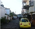
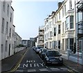
IMAGES TAKEN NEAR TO
Bristol Road, BRIGHTON, BN2 1AP

Introduction

This page details the photographs taken nearby to Bristol Road, BN2 1AP by members of the Geograph project.

The Geograph project started in 2005 with the aim of publishing, organising and preserving representative images for every square kilometre of Great Britain, Ireland and the Isle of Man.

There are currently over 7.5m images from over14,400 individuals and you can help contribute to the project by visiting https://www.geograph.org.uk

Image Map


Images are licensed for reuse under creativecommons.org/licenses/by-sa/2.0
Notes
  • Clicking on the map will re-center to the selected point.
  • The higher the marker number, the further away the image location is from the centre of the postcode.

Image Listing (516 Images Found)

Images are licensed for reuse under creativecommons.org/licenses/by-sa/2.0
  • ...
Image
Details
Distance
1
Bristol Road, BN2
Image: © Mike Quinn Taken: 24 Apr 2012
0.02 miles
2
Bristol Road, Kemp Town, Brighton
The B2118 as it heads towards the junction with Bedford Street and Upper Bedford Street that was developed from the early 1860s onwards. On the right is the St Joseph's Convent of Mercy that have occupied the site since the 1850s and the current building since 1893. Beyond the convent just visible behind the tree is Image
Image: © Simon Carey Taken: 4 Oct 2015
0.03 miles
3
Royal Crescent Mews, Kemp Town, Brighton
The mews lies to the rear of Royal Crescent which was built between 1798-1807 and contains a row of small cottages which originally housed those servicing the great and good in the houses in front.
Image: © Simon Carey Taken: 1 Nov 2015
0.03 miles
4
Crescent Villa, Bristol Road
Small town house at the end of the Royal Crescent development that causes the B2118 to travel around it.
Image: © Simon Carey Taken: 11 Jan 2009
0.03 miles
5
St. John The Baptist Catholic Chapel, Bristol Road, BN2
Image: © Mike Quinn Taken: 24 Apr 2012
0.03 miles
6
St John the Baptist Church, Bristol Road, Kemp Town, Brighton
A Catholic church that was opened in 1835 and contains the tomb of Maria Fitzherbert, 'wife' of George IV
Image: © Simon Carey Taken: 4 Oct 2015
0.03 miles
7
St. George's Terrace, BN2 (2)
Image: © Mike Quinn Taken: 24 Apr 2012
0.04 miles
8
St George's Terrace, Kemp Town, Brighton
A residential street that runs from St george's Road, the B2118, and Upper Bedford Street that was developed in the 1840s.
Image: © Simon Carey Taken: 4 Oct 2015
0.05 miles
9
Royal Crescent
See Image for more information.
Image: © Simon Carey Taken: 20 Feb 2009
0.05 miles
10
St. George's Terrace, BN2
Image: © Mike Quinn Taken: 24 Apr 2012
0.05 miles
  • ...