IMAGES TAKEN NEAR TO
Bourne Street, EASTBOURNE, BN21 3DW
Introduction
This page details the photographs taken nearby to Bourne Street, BN21 3DW by members of the Geograph project.
The Geograph project started in 2005 with the aim of publishing, organising and preserving representative images for every square kilometre of Great Britain, Ireland and the Isle of Man.

There are currently over 7.5m images from over14,400 individuals and you can help contribute to the project by visiting https://www.geograph.org.uk
Image Map
Images are licensed for reuse under creativecommons.org/licenses/by-sa/2.0
Notes
- Clicking on the map will re-center to the selected point.
- The higher the marker number, the further away the image location is from the centre of the postcode.
Image Listing (622 Images Found)
Images are licensed for reuse under creativecommons.org/licenses/by-sa/2.0
Image
Details
Distance
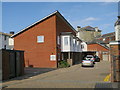
2
![Eastbourne houses [13]](https://s2.geograph.org.uk/geophotos/07/20/10/7201002_913deb0e_120x120.jpg)
Eastbourne houses [13]
Now flats, number 20 Seaside, has seen a number of roles. Originally a private residence, Livingstone House. Later Ballroom House and a social centre for the local garrison. Later still, the Busy Bee Restaurant. Built in the early 19th century of stuccoed brick under a slate mansard roof. Listed, grade II, with details at: https://historicengland.org.uk/listing/the-list/list-entry/1043653
Eastbourne is a town and seaside resort on the south coast of East Sussex, some 54 miles south of London and about 19 miles east of Brighton. Although there is evidence of settlement from the Stone Age onwards, Eastbourne remained an area of small rural settlements until the railway arrived in 1849. A resort, built "for gentlemen by gentlemen", was planned and the town's growth accelerated from a population of less than 4,000 in 1851 to nearly 35,000 by 1891. Tourism is a large and important part of the economy of the town.
Image: © Michael Dibb
Taken: 5 May 2022
0.02 miles
3
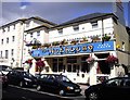
The Nuthouse
Public house in Seaside Road Eastbourne
Image: © PAUL FARMER
Taken: 17 Jul 2009
0.02 miles
4
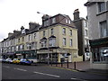
Ice Cream Parlour and Sea Houses Square Eastbourne
Image: © PAUL FARMER
Taken: 17 Jul 2009
0.03 miles
5
![Eastbourne features [35]](https://s2.geograph.org.uk/geophotos/07/20/02/7200250_494f271d_120x120.jpg)
Eastbourne features [35]
An information board about some buildings and other features in Seaside.
Eastbourne is a town and seaside resort on the south coast of East Sussex, some 54 miles south of London and about 19 miles east of Brighton. Although there is evidence of settlement from the Stone Age onwards, Eastbourne remained an area of small rural settlements until the railway arrived in 1849. A resort, built "for gentlemen by gentlemen", was planned and the town's growth accelerated from a population of less than 4,000 in 1851 to nearly 35,000 by 1891. Tourism is a large and important part of the economy of the town.
Image: © Michael Dibb
Taken: 3 May 2022
0.03 miles
6
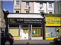
Eastbourne Liberal Democrats offices
At 100 Seaside Road.
Image: © PAUL FARMER
Taken: 17 Jul 2009
0.03 miles
7
![Eastbourne houses [4]](https://s1.geograph.org.uk/geophotos/07/19/94/7199413_c8e1fdbe_120x120.jpg)
Eastbourne houses [4]
Numbers 27 and 28 Marine Parade are a pair of houses built circa 1840. Constructed of stuccoed brick under a slate roof. The first floor balconies are supported on four Doric columns. Listed, grade II, with details at: https://historicengland.org.uk/listing/the-list/list-entry/1043644
Eastbourne is a town and seaside resort on the south coast of East Sussex, some 54 miles south of London and about 19 miles east of Brighton. Although there is evidence of settlement from the Stone Age onwards, Eastbourne remained an area of small rural settlements until the railway arrived in 1849. A resort, built "for gentlemen by gentlemen", was planned and the town's growth accelerated from a population of less than 4,000 in 1851 to nearly 35,000 by 1891. Tourism is a large and important part of the economy of the town.
Image: © Michael Dibb
Taken: 3 May 2022
0.04 miles
8

Seahouses Square
Seahouses* Square links Marine Parade with the A259, Seaside. The water fountain in the centre of the square, known as The Curling Drinking Fountain, was originally erected in 1865. It was moved to the corner with Langney Road in the 1950s because it was causing an obstruction to traffic. In 2000, it was restored and relocated to its present position. The fountain is a Grade II listed structure (http://www.britishlistedbuildings.co.uk/en-293634-drinking-fountain-eastbourne British Listed Buildings).
(details from a nearby information board)
*Seahouses was one of the four hamlets which became Eastbourne from 1850 onwards (http://www.eastbournelive.org.uk/6.html “old Eastbourne” Eastbourne Live)
Image: © David Dixon
Taken: 4 Aug 2012
0.04 miles
9

Curling Drinking Fountain (plaque)
The plaque on Image] reads:
ERECTED AD MDCCCLXV
JESUS SAID
WHOSOEVER DRINKETH
OF
THIS WATER
SHALL THIRST AGAIN
Image: © David Dixon
Taken: 4 Aug 2012
0.04 miles
