IMAGES TAKEN NEAR TO
Hartfield Road, EASTBOURNE, BN21 2AP
Introduction
This page details the photographs taken nearby to Hartfield Road, BN21 2AP by members of the Geograph project.
The Geograph project started in 2005 with the aim of publishing, organising and preserving representative images for every square kilometre of Great Britain, Ireland and the Isle of Man.

There are currently over 7.5m images from over14,400 individuals and you can help contribute to the project by visiting https://www.geograph.org.uk
Image Map
Images are licensed for reuse under creativecommons.org/licenses/by-sa/2.0
Notes
- Clicking on the map will re-center to the selected point.
- The higher the marker number, the further away the image location is from the centre of the postcode.
Image Listing (81 Images Found)
Images are licensed for reuse under creativecommons.org/licenses/by-sa/2.0
Image
Details
Distance
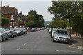
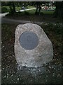
2
Hartfield Road
Hartfield Square to the right.
Image: © Oast House Archive
Taken: 4 Jul 2011
0.03 miles
3
Queen Elizabeth II Field sign at Hartfield Square, Eastbourne
Image: © PAUL FARMER
Taken: 19 Apr 2014
0.04 miles
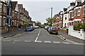
4
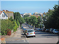
St Anne's Road
Towards the town centre.
Image: © Oast House Archive
Taken: 4 Jul 2011
0.07 miles
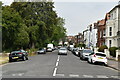
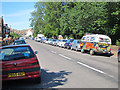
7
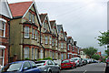
Houses on Bedford Grove
Houses typical of this area of Eastbourne.
Image: © Robin Webster
Taken: 11 Jun 2010
0.10 miles
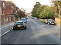
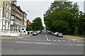
8
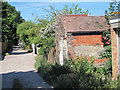
Track behind Enys Road
Looking from St Anne's Road.
Image: © Oast House Archive
Taken: 4 Jul 2011
0.11 miles