
IMAGES TAKEN NEAR TO
Tower Road, BRIGHTON, BN2 0FZ
Introduction
This page details the photographs taken nearby to Tower Road, BN2 0FZ by members of the Geograph project.
The Geograph project started in 2005 with the aim of publishing, organising and preserving representative images for every square kilometre of Great Britain, Ireland and the Isle of Man.

There are currently over 7.5m images from over14,400 individuals and you can help contribute to the project by visiting https://www.geograph.org.uk
Image Map
Images are licensed for reuse under creativecommons.org/licenses/by-sa/2.0
Notes
- Clicking on the map will re-center to the selected point.
- The higher the marker number, the further away the image location is from the centre of the postcode.
Image Listing (251 Images Found)
Images are licensed for reuse under creativecommons.org/licenses/by-sa/2.0
Image
Details
Distance
1
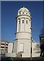
Pepper Pot
Resplendent in the November sun after its recent refurbishment
Image: © Paul Gillett
Taken: 13 Nov 2011
0.00 miles
2
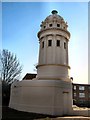
Pepper Pot
Viewed from near Queens Park Road a few days after the scaffolding was removed following major refurbishment
Image: © Paul Gillett
Taken: 13 Nov 2011
0.02 miles
3
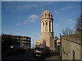
Pepper Pot near Queens Park Brighton
see Image] for a later view (2011) after refurbishment
Image: © Paul Gillett
Taken: 22 Jan 2006
0.02 miles
4
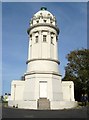
The Pepper Pot, Tower Road, Brighton
Built around 1830 as part of the grounds of Attree Villa constructed at the same time, its original purpose is uncertain and may have been either a water or observation tower, though an 1836 article claims the tower housed a steam engine used to draw water from wells below. Attree's former estate was broken up in the early 1890s and the tower by now known as the Pepper Box was acquired by the council. They installed a sewer vent within the structure around 1900 and added public conveniences at the base in the 1920s. During the 1930s it was used by the local scouts and was an observation tower throughout the Second World War. By the 1970s it was used as an artists studio. The toilets closed in the 1990s which was also the last time the structure appeared to be used and is now empty. A group, 'Friends of the Pepper Pot' are currently raising funds to restore the building and it put it to some use.
Image: © Simon Carey
Taken: 25 Oct 2015
0.02 miles

6
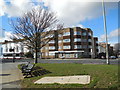
Sidney Tidy House
Sidney Tidy House is a small sheltered housing scheme built in 1978 at the corner of Queens Park Road and Islingword Road and located within a short walk of Queens Park in Hanover, Brighton http://www.housingcare.org/housing-care/facility-info-5932-sidney-tidy-house-queens-park-england.aspx
Image: © Paul Gillett
Taken: 13 Feb 2014
0.02 miles
7
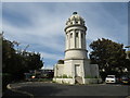
The Pepper Pot, Brighton
The Pepper Pot is a listed building near Queen's Park in Brighton. The building is Grade II listed, and is a surviving remnant from the grounds of a villa which stood nearby.
Image: © Malc McDonald
Taken: 24 Aug 2019
0.02 miles
9
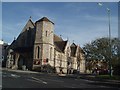
St Luke's Church
The Church situated near to Queen's Park was built in 1885 with flint walls, and stained glass
http://www.saintlukesbrighton.org/home
Image: © Paul Gillett
Taken: 26 Oct 2009
0.02 miles
10
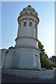
The Pepper Pot
Grade II listed. https://britishlistedbuildings.co.uk/101381031-the-tower-or-pepper-pot-queens-park-ward
Image: © N Chadwick
Taken: 7 Jul 2018
0.02 miles