
IMAGES TAKEN NEAR TO
Evelyn Terrace, BRIGHTON, BN2 0EP
Introduction
This page details the photographs taken nearby to Evelyn Terrace, BN2 0EP by members of the Geograph project.
The Geograph project started in 2005 with the aim of publishing, organising and preserving representative images for every square kilometre of Great Britain, Ireland and the Isle of Man.

There are currently over 7.5m images from over14,400 individuals and you can help contribute to the project by visiting https://www.geograph.org.uk
Image Map
Images are licensed for reuse under creativecommons.org/licenses/by-sa/2.0
Notes
- Clicking on the map will re-center to the selected point.
- The higher the marker number, the further away the image location is from the centre of the postcode.
Image Listing (139 Images Found)
Images are licensed for reuse under creativecommons.org/licenses/by-sa/2.0
Image
Details
Distance
2
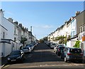
Cuthbert Road, Brighton
A residential road that runs between Sutherland Road and Freshfield Road that was developed in the late 1870s, early 1880s.
Image: © Simon Carey
Taken: 11 Oct 2015
0.03 miles
4
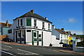
Green's, Freshfield Road, Brighton
Bar. Restaurant. Garden. On the corner of Cuthbert Road. Formerly Hemingways, formerly the Cuthbert Arms. Until the proprietor's press statement was found when it was opened as Green's in December 2009, the classification for this was doubtful. He called it a pub, so we will as well.
Image: © Robin Webster
Taken: 30 Apr 2010
0.05 miles
5
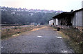
Kemp Town goods yard 1971
Taken shortly after its closure in 1971, the photo shows in the distance the southern end of the tunnel of the Kemp Town branch line.
Image: © Gordon Spicer
Taken: Unknown
0.05 miles
6
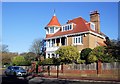
House in East Drive
opposite Queens Park
Image: © Paul Gillett
Taken: 11 Nov 2012
0.05 miles
7
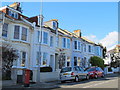
Freshfield Road, BN2 (3)
Shows the location of Image
Image: © Mike Quinn
Taken: 20 Apr 2012
0.06 miles
8
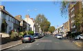
Sutherland Road, Brighton
The road runs north from Eastern Road becoming Queensway beyond the tree on the right in the far distance where it continues up to the racecourse. The flats on the right are St Matthews Court built on the site of St Matthews Church which was closed in 1962 and demolished in 1967.
Image: © Simon Carey
Taken: 11 Oct 2015
0.06 miles
10
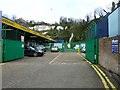
Hidden history on the Freshfield Industrial Estate
A very similar photo as Simon Carey's Image showing the southern portal at the old Kemp Town station, unfortunately due to the blue container only one support is visible.
A photo taken by my Father shows the tunnel shortly after its closure in 1971 Image
Image: © Dave Spicer
Taken: 6 Feb 2012
0.06 miles