1
52, Carlton Hill, Brighton
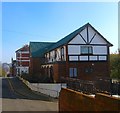
Located on the corner of Marine View is the former Devonshire public house which closed around 2008, the last of the pubs in Carlton Hill which once numbered fifteen. The original pub dates from the 1840s but was rebuilt during the 1930s.
Image: © Simon Carey
Taken: 1 Nov 2015
0.01 miles
2
Small Factory, Marine View
Head east down Sussex Street the south down Queens Park Road then west along Park Road Terrace. A survivor of the slum clearances in this area which had started in the 1930s but only completed in the 1960s. The houses to the right are the only other survivors.
Click on the link to take you to the next page. http://www.geograph.org.uk/photo/232043
Image: © Simon Carey
Taken: 1 Sep 2006
0.01 miles
3
Lennox Street, Brighton
Image: © Josie Campbell
Taken: 24 Nov 2007
0.02 miles
4
Parks View, Upper Park Place, Brighton
The flats date from the mid 1960s and were originally the rebuilt Red Lion public house which closed around ten years ago. The original pub opened in the 1850s and was rebuilt when the area was largely cleared of housing, see http://regencysociety-jamesgray.com/volume24/source/jg_24_150.html for a view of the former pub building.
Image: © Simon Carey
Taken: 1 Nov 2015
0.03 miles
5
Zylo Works, Marine View, Brighton
Tucked away on the corner of Marine View and Park Road Terrace is one of the few manufacturing centres left in the centre of the city. The Zylo Works were established by Malby & Co formed 1810, a London firm, after the First World War to manufacturer nameplates. The works were extended during the 1930s and became the headquarters of the firm during the Second World War when they moved all production here to escape the blitz. During the conflict they made items for aircraft and maintained close links with the aerospace industry after. Still producing nameplates today under the London Name Plate Company and still run by the same family. The factory was one of the few buildings to survive along with the terrace to the right when the area bounded by St John's Place, Carlton Hill, Upper Park Place and Sussex Street was cleared of slum housing in the 1960s. Carlton Place, whose nameplate can be seen in the foreground was one of the streets completely demolished and replaced with flats truncating the street in the process.
Image: © Simon Carey
Taken: 1 Nov 2015
0.03 miles
6
Lennox Street, Brighton
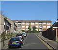
The street originally ran from Carlton Street to Sussex Street and was developed in the 1840s but was demolished around 1962 removing the northern end at the junction with Sussex Street turning the road into a cul de sac. See http://regencysociety-jamesgray.com/volume24/source/jg_24_150.html for a 1962 pre-demolition view.
Image: © Simon Carey
Taken: 1 Nov 2015
0.04 miles
7
Mount Pleasant, Brighton
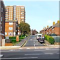
The road was originally laid out in the 1800s but was anything but pleasant as the area north of Edward Street and west of egremont Place soon became a slum area. The eastern side was cleared and rebuilt in the 1930s but the western side had to wait until the 1960s. St John's Mount is the block of flats on the left.
Image: © Simon Carey
Taken: 4 Oct 2015
0.04 miles
8
Sussex Street
Head south down Windmill Street then east down Sussex Street. This is looking at its junction with Queens Park Road and is the opposite view to the one Bob Embleton took for this square.
Click on the link to take you to the next page. http://www.geograph.org.uk/photo/232042
Image: © Simon Carey
Taken: 1 Sep 2006
0.05 miles
9
Entrance gates to Queen's Park, Brighton
Dated 1890. Viewed from the south.
Image: © Bob Embleton
Taken: 9 Sep 2005
0.05 miles
10
Egremont Place Gate
Head east along Carlton Hill then north up Upper Park Place then east along the remainder of Queens Park Road until the junction with Egremont Place. This is one of two gates constructed as entrances to Queens Park. The other is in the next grid square a few hundred metres to the east. Designed by Charles Barry (St Peters Church and Houses of Parliament) in 1829 and rebuilt in 1890 after the park became public.
Click on the link to take you to the next page. http://www.geograph.org.uk/photo/232050
Image: © Simon Carey
Taken: 1 Sep 2006
0.05 miles


