1
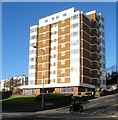
Belle Vue Gardens, Brighton
A residential road that runs from Eastern Road to Walpole Road but also has a western arm that links the western section of Walpole Road next to Brighton College. This is a view of the latter. The road was developed in the grounds of a former villa, Belle Vue House built in 1868, in the first decade of the 20th century. The villa was demolished in 1968 though the garden wall to the right still survives.
Image: © Simon Carey
Taken: 13 Nov 2015
0.03 miles
2
Walpole Road, Brighton
A residential road that runs north from Eastern Road then turns east and ends at Whitehawk Hill Road. Much of the road was developed in the late 1860s though parts have been rebuilt.
Image: © Simon Carey
Taken: 4 Oct 2015
0.03 miles
3
Upper Abbey Road, Brighton
A residential road that links Walpole Road to Eastern Road which was originally a continuation of Abbey Road. The houses were built in the first decade of the 20th century whilst the road was renamed in the 1920s.
Image: © Simon Carey
Taken: 13 Nov 2015
0.05 miles
4
145-161, Eastern Road, Brighton
Located on the northern side between Brighton College Prep School and Belle Vue Gardens and built in the first decade of the 20th century. On the opposite side are
Image
Image: © Simon Carey
Taken: 13 Nov 2015
0.05 miles
5
Courtney King House, Eastern Road, Brighton
Located in a triangle of land between the junctions of Eastern Road and Belle Vue gardens and Upper Abbey Road. The flats are sheltered housing and were built in 1972 on the former site of Durnford House.
Image: © Simon Carey
Taken: 13 Nov 2015
0.05 miles
6
Eastern Road, BN2
Image: © Mike Quinn
Taken: 20 Apr 2012
0.05 miles
7
Convent of the Blessed Sacrament Chapel, Walpole Road, Brighton
Built in 1913 as the chapel for the convent, the white building beyond. Both buildings are now owned by Brighton College, the former convent has been the prep school since 1971, whilst the chapel has been in their ownership since 1961 and is still used for that purpose. Located on the corner of Belle Vue Gardens.
Image: © Simon Carey
Taken: 13 Nov 2015
0.06 miles
8
Walpole Road
Minor road that connects Whitehawk Hill Road with Eastern Road. St John's College is to the right.
Image: © Simon Carey
Taken: 29 Aug 2011
0.06 miles
9
Walpole Road, Brighton
A residential road that runs from Whitehawk Hill Road westwards to Brighton College then turns south to Eastern Road. The road was laid out in the 1860s but only Hamilton Lodge, the white building on the right further down the slope, now a school for the deaf, was built at that time. The rest was developed in the first decade of the 20th century. The eastern end of the road occupies the southern slope of Whitehawk Hill which climbs quite steeply here but allows for excellent views over the city.
Image: © Simon Carey
Taken: 13 Nov 2015
0.06 miles
10
Walpole Road, BN2
Image: © Mike Quinn
Taken: 20 Apr 2012
0.06 miles


