IMAGES TAKEN NEAR TO
Eastern Road, BRIGHTON, BN2 0AG
Introduction
This page details the photographs taken nearby to Eastern Road, BN2 0AG by members of the Geograph project.
The Geograph project started in 2005 with the aim of publishing, organising and preserving representative images for every square kilometre of Great Britain, Ireland and the Isle of Man.

There are currently over 7.5m images from over14,400 individuals and you can help contribute to the project by visiting https://www.geograph.org.uk
Image Map
Images are licensed for reuse under creativecommons.org/licenses/by-sa/2.0
Notes
- Clicking on the map will re-center to the selected point.
- The higher the marker number, the further away the image location is from the centre of the postcode.
Image Listing (383 Images Found)
Images are licensed for reuse under creativecommons.org/licenses/by-sa/2.0
Image
Details
Distance
1
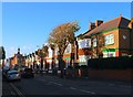
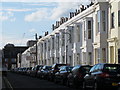
145-161, Eastern Road, Brighton
Located on the northern side between Brighton College Prep School and Belle Vue Gardens and built in the first decade of the 20th century. On the opposite side are Image
Image: © Simon Carey
Taken: 13 Nov 2015
0.01 miles
3
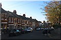
Belle Vue Gardens, Brighton
A residential road that runs from Eastern Road to Walpole Road but also has a western arm that links the western section of Walpole Road next to Brighton College. This is a view of the latter. The road was developed in the grounds of a former villa, Belle Vue House built in 1868, in the first decade of the 20th century. The villa was demolished in 1968 though the garden wall to the right still survives.
Image: © Simon Carey
Taken: 13 Nov 2015
0.02 miles
4
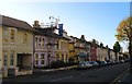
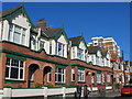
146-162, Eastern Road, Brighton
A terrace of houses located on the southern side of the road built in the 1860s and originally known as Arlington Villas. On the opposite side are Image
Image: © Simon Carey
Taken: 13 Nov 2015
0.02 miles
5
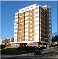
Courtney King House, Eastern Road, Brighton
Located in a triangle of land between the junctions of Eastern Road and Belle Vue gardens and Upper Abbey Road. The flats are sheltered housing and were built in 1972 on the former site of Durnford House.
Image: © Simon Carey
Taken: 13 Nov 2015
0.03 miles
7
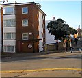
Ronald McDonald House, Abbey Road, Kemp Town, Brighton
Located on the corner of Eastern Road. The flats belong to the Ronald McDonald House Charity which provides accommodation for families with children in hospital.
Image: © Simon Carey
Taken: 13 Nov 2015
0.05 miles
8

Kemp Town, hospital
Royal Sussex County Hospital, on Eastern Road: https://www.bsuh.nhs.uk/hospitals/royal-sussex-county-hospital/
Image: © Mike Faherty
Taken: 22 Sep 2018
0.05 miles
9
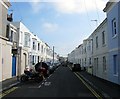
Great College Street, Kemp Town, Brighton
A residential road linking College Place with Abbey Road that was developed in the late 1850s. Whilst no houses in the street are listed at least three lamp posts are.
Image: © Simon Carey
Taken: 4 Oct 2015
0.05 miles